Phu Gaon
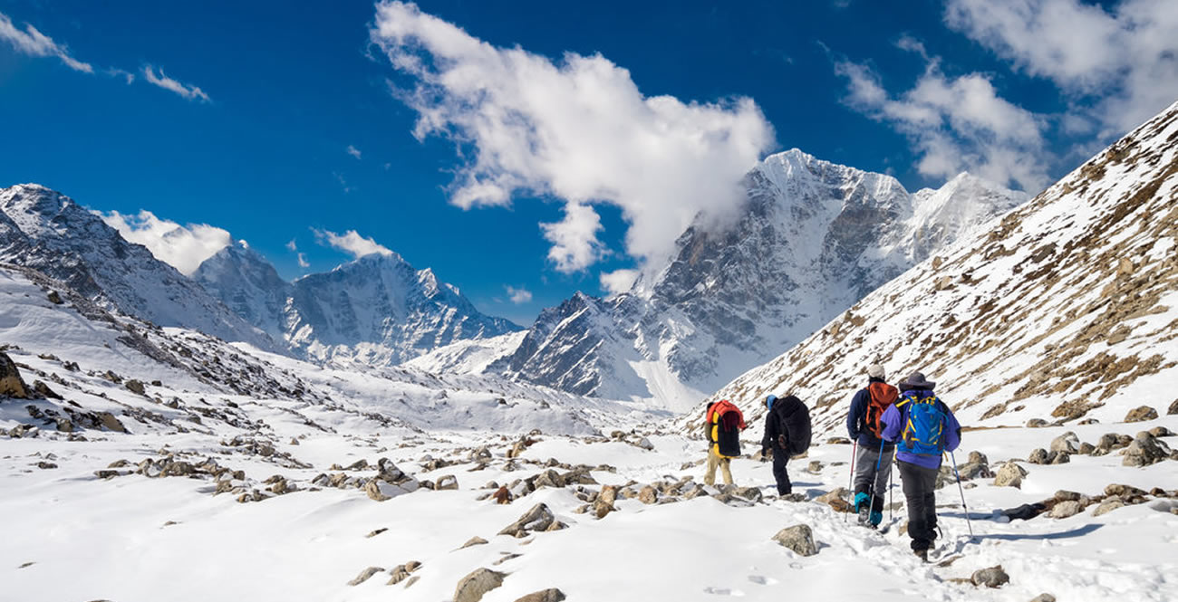
I’m trekking in the Nar-Phu Valley, a remote and sparsely visited region near the Tibetan border which is open to tourism since 2002. The trail leads along the Phu River in a deep gorge; often the path is very exposed, cut into vertical cliffs hundreds of meters above the river. To the west is Pisang Peak, to the east is Mount Kanguru, the view back south is dominated by Lamjung Himal and the tremendous Annapurna II. I pass through old, abandoned Khampa settlements; with every step I walk north the landscape gets drier and drier.
After two days I reach Phu Gaon a few hundred of years back in time. Dark flat stone houses, prayer flags everywhere, narrow alleys. Next day I hike up the hill next to the village to the Tashi Lhakhang Gompa. The weather is perfect, the location of this small monastery beautiful. The hill is full of Chortens, colourful Mani walls and hundreds of prayer flags blowing in the wind.
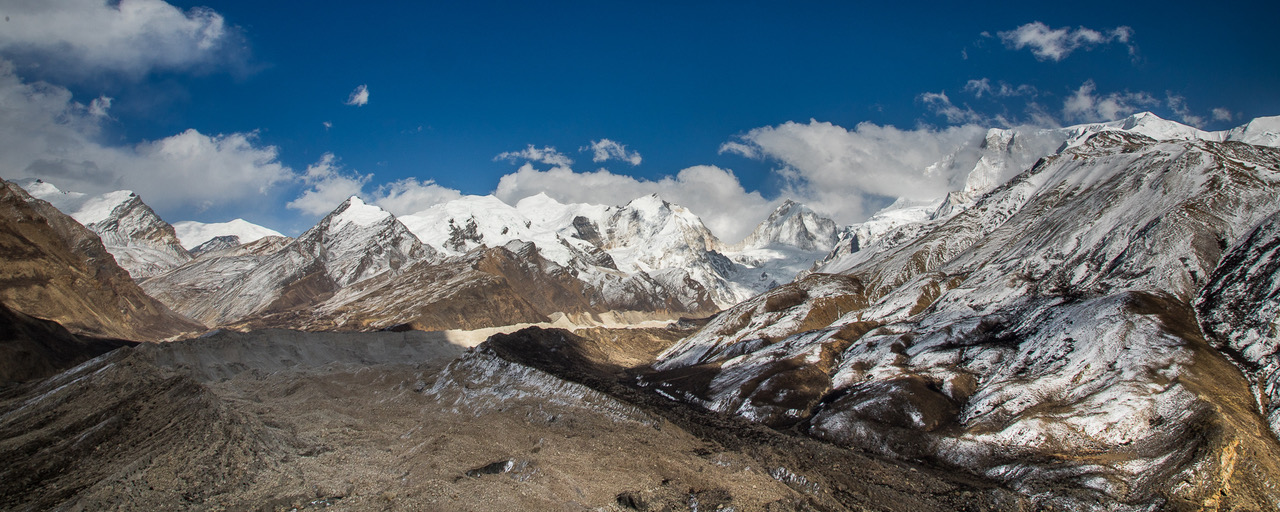
Later on I continue towards Himlung Himal (7126m), the path is hard to find, I follow the moraine east. Altitude, strong wind, dehydration and the exertion all contribute to a splitting headache. From the top of the moraine I get my view of Himlung, Nemjung and Himjung, beautiful White Mountains, in stark contrast to the brown hills in this dry area.
Nar Gaon
Next day I walk from Phu Gaon to the other village in this area, Nar Gaon. I follow the valley south, after a few hours the path branches off to the west. The views are spectacular: Kanguru to the east, Lamjung Himal and Annapurna II south, Pisang Peak straight ahead looks rather bleak from the north.
Early afternoon I reach Nar Gaon. I stroll around the village, thinking about the next days. Tomorrow I want to set off early to cross the Kang La Pass (5322m). Then it begins to snow heavily.
Next morning the whole valley is covered with a thick layer of snow. All I can do today is stay here and wait. I go for a walk through the village, the warm sun melts the snow quickly. In the evening the weather finally improves. The sky clears, revealing Pisang Peak and Kanguru, illuminated red by the setting sun.
Kang La (5322m)
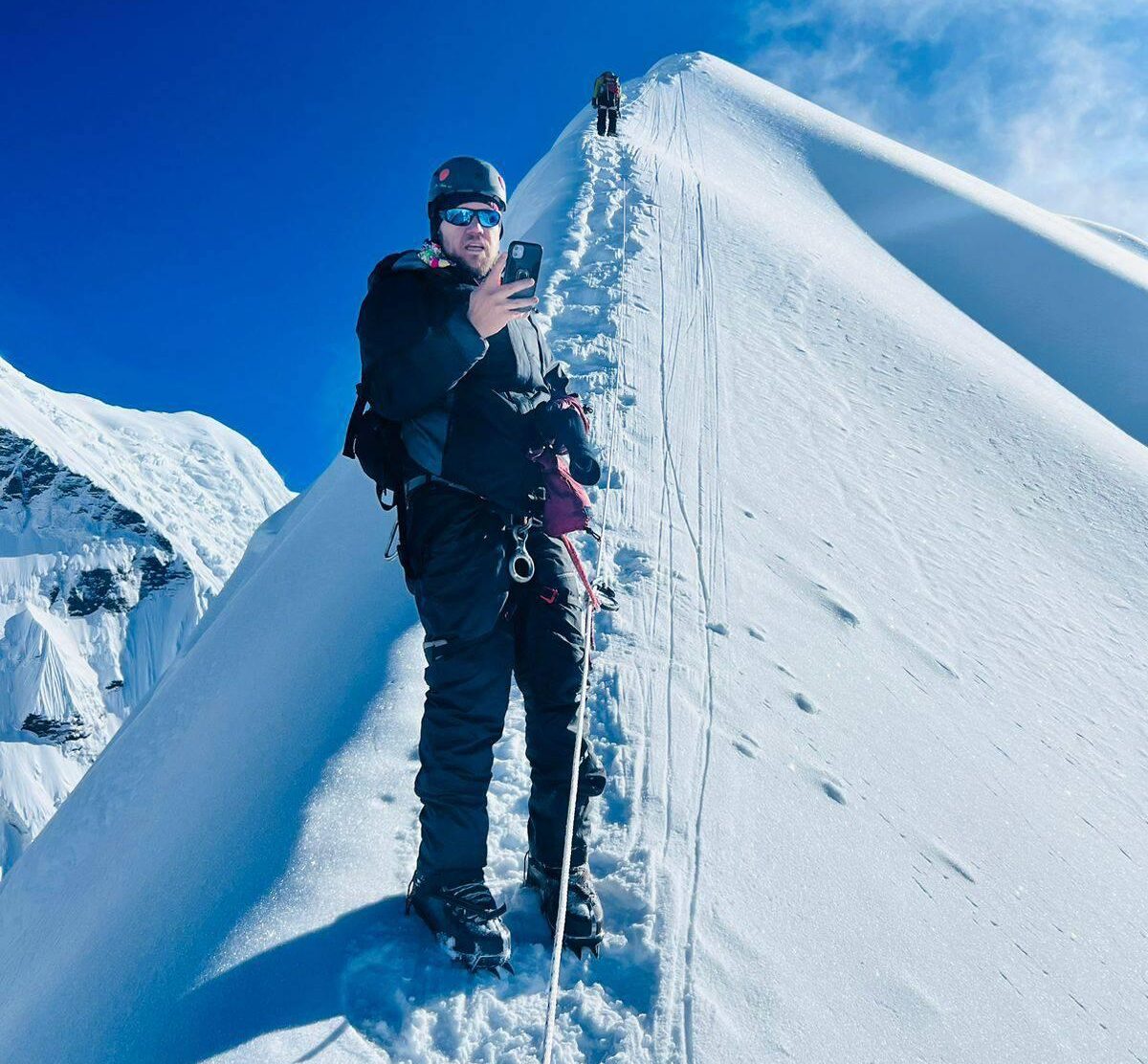
My alarm goes off at 3, at 3:30 I start from the lodge. The stars in the sky and my headlamp are guiding my way through the night. I move up the valley quickly, trying to reach the pass as early as possible before the clouds roll in. For some time I follow a little stream, the trail is faintly visible through the snow. I ascend the slope to my right, then I continue west. After a while the narrow valley opens up a bit. At the head of the valley I can now see the trail again, zigzagging up the slope towards the pass. After what feels like an eternity I reach the end of the valley and join the path again! Now the hard work begins, up the long, steep slope towards Kang La. The last few hundred meters are particularly strenuous, through knee-deep snow. I need to rest a lot, the view east is incredible. Manaslu, Ngadi Chuli, Himal Chuli can be seen in the far distance, Kanguru, Pisang Peak, Chombi and Gyaji Kang are shining bright in the early morning sun.
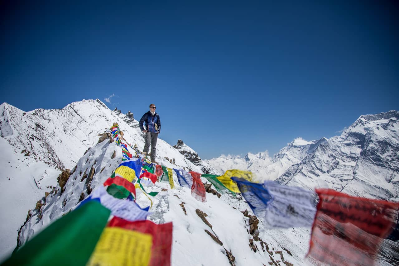
Finally I reach the pass (5322m), marked by a cairn with a sign and prayer flags. I’m glad I reached pass early enough, hardly any clouds in the sky. And what a view! The whole Annapurna range is unfolding before my eyes. Annapurna II (7937m) is simply breathtaking and dominates the view. Lamjung Himal and the Myabasa Danda ridge to the south-east, Annapurna III, Gangapurna, Roc Noir and Grande Barriere south-west. I can even see the very tops of Machhapuchhare and Annapurna I – a rare pleasure from the north.
I have a long break on the pass, and then I start the 1700m descent to Ngawal. The first few meters down are steep and treacherous, over loose, slippery slabs. Very slowly, step by step I make my way downwards.
After a while the slope eases. I take it easy for the rest of the descent; it’s a long but easy stroll down to Ngawal. At 11am I reach Ngawal. It is still early, I don’t feel too tired and so I continue to Manang. I’m now back on the popular Annapurna Circuit.
Great Ice Lake
From Manang I’m heading for Tilicho Lake (4920m). In Khangsar I stop for tea. From Khangsar I go on, after a while the infamous landslide area begins.
Quickly I continue on the narrow trail, past bizarre looking rock formations, the river deep below to my left. I stay the night at the Tilicho Base Camp Lodge. Next morning I have an early start, it snowed at night and the landscape looks winterly. Grande Barriere and Roc Noir get closer with each step, the view back on Gangapurna, Chulus and the Marsyangdi Valley is awesome.
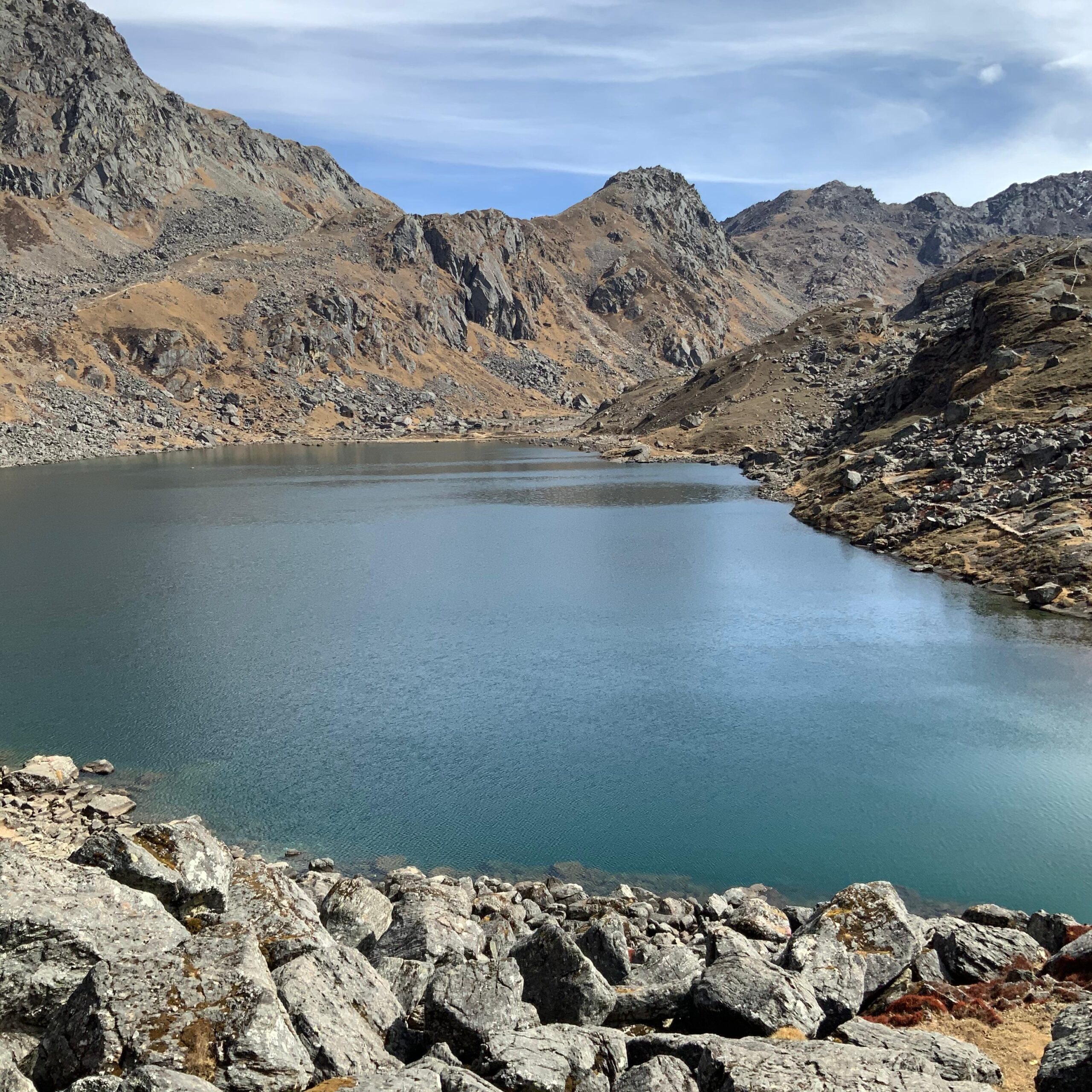
Soon the path eases; some more walking on flat ground, then the lake comes in sight!
Roc Noir and Tilicho Peak are hidden by clouds, small avalanches roar down the slopes of the Great Barrier. Glaciers reaching right into the lake are cracking loud. I walk around the viewpoint at the south-eastern shore, it is cold and windy and after a couple of hours I go back.
Thorong La (5416m)
Next morning I walk in bad weather from Shree Kharka to Thorong Phedi. I pass Gunsang, Yak Kharka, Ledar, and cross the suspension bridge between Ledar and Thorong Phedi. In the afternoon the weather improves, I walk through another landslide area but the path is well trodden and easy to negotiate. On the slopes above I can see plenty of blue sheep.
This is snow leopard territory and I constantly keep an eye out for the big cat – in vain. Eventually I reach the lodges of Thorong Phedi (4530m), the sky clears for sunset revealing great views back on Gangapurna.
Next day I start at 5 towards the Thorong La Pass. Day is already dawning, making my headlamp needless. It is a bitterly cold, clear morning. I follow the line of trekkers trudging up the hill. Then the sun finally rises over the mountains, warming me up instantly.
At 8 I reach the Thorong La (5416m), notched in between the sixthousanders Khatung Khang and Yakawa Kang. The view from the pass exceeds my expectations. The Chulu Peaks, Putrun Himal and the ever present Annapurna II are towering skyhigh in the east; the Kali Gandaki Valley lies deep below in the west.
It is extremely windy and I start the long descent to Muktinath very soon. I more or less run down, losing altitude quickly. Before noon I arrive in Muktinath (3760m), a sacred place for both Hindus and Buddhists. I spend some time resting and watching the many Indian and Nepalese pilgrims at the main temple, and then I go to the neighbouring town of Ranipauwa for lunch.
Kali Gandaki Valley
In the afternoon I continue to the medieval town of Jhong. From the slopes north of Jhong I get fantastic views on the Nilgiris, Tilicho Peak and Dhaulagiri I, even the top of elusive Annapurna I comes into sight.
Walking through Jhong I’m looking for a place to stay the night but all the lodges seem to be closed. I have no choice but to go on with heavy legs. Dead tired and just before sunset I arrive at Kagbeni.
Next day I spend the morning exploring town and its surrounding area. With its ancient houses and beautiful location at the Kali Gandaki River, this place blows me away.
For a short distance I walk north along the Kali Gandaki River to the tiny settlement of Tiri. Like yesterday the weather is just perfect. In Tiri I hike up to the small monastery for more beautiful views. From this vantage point I can peek into Mustang, the former Tibetan kingdom in the north.
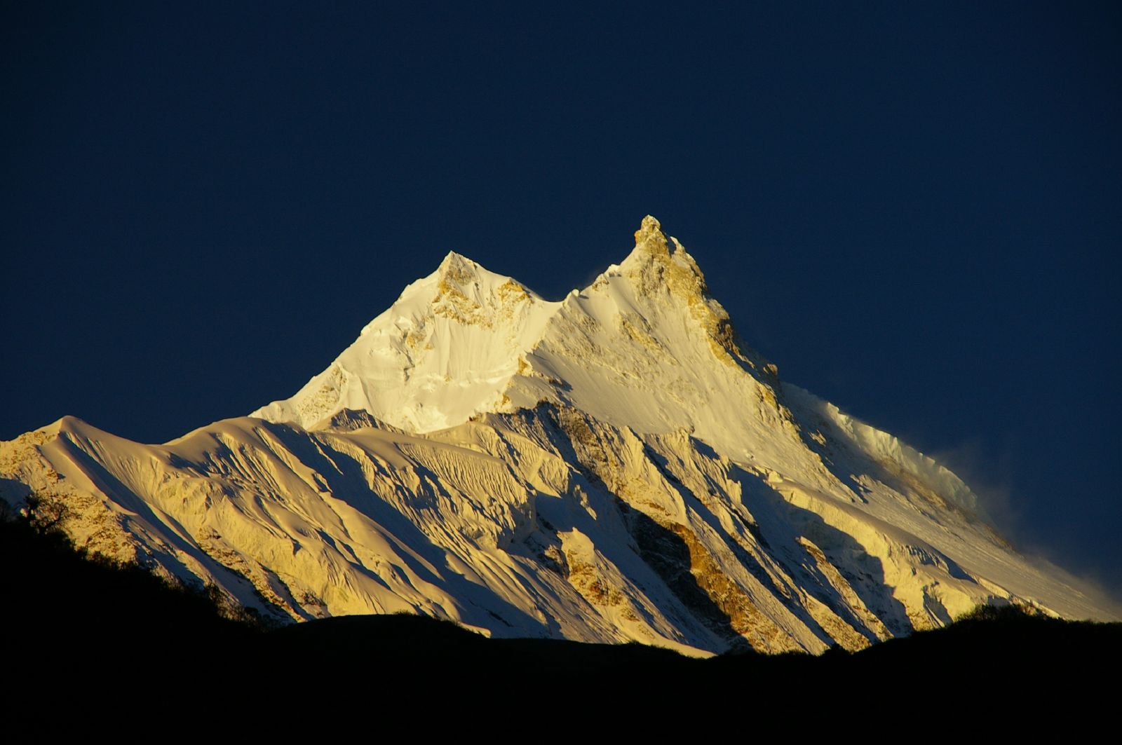
Two days later, I’m heading south along the Kali Gandaki to Kalopani. I take it easy and do plenty of side trips off the main trail. In the beautiful village of Naurikot I stop for breakfast and enjoy the awesome views, especially on Dhaulagiri I, the seventh highest mountain in the world.
Dhaulagiri I (8167m)
I continue west from Naurikot and ascend the lower slopes of Dhaulagiri to a small cave and waterfall. From here views are even better. At this point the Kali Gandaki Valley is one of the deepest valleys in the world, with an altitude as low as 2550m in between the eight-thousanders Annapurna and Dhaulagiri.
Khayar Lake (4600m)
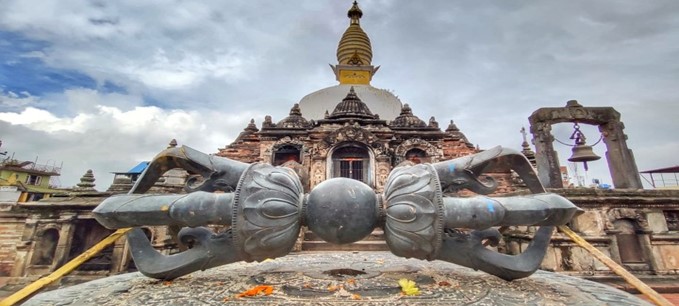
From the lodge at Kopra Dhanda I start at 5 towards Khayar Lake, a sacred lake for Hindus at the foot of Annapurna South. It’s a hazy morning, I’m praying for good weather today. The trail to the lake is okay to find, frequently walked by pilgrims. After a couple of hours I cross the snow line, at around 9 I reach the lake at ~4600m. The shore is lined with tridents and bells, symbols of the Hindu god Shiva. I circumambulate the lake, scramble on the slopes around and take in the wonderful scenery. Clouds come and go, allowing close-up views on Fang and Annapurna South occasionally.
Through thick fog I walk back, retracing my own footsteps in the snow. The atmosphere is eerie, the view very limited. Luckily it doesn’t rain.
Next day I descend in the rain from Kopra Dhanda to Tadapani through a dense forest. I pass Bayeuli and Dobato, in the afternoon I reach the lodges of Tadapani, beautifully located at a scenic clearing.
The trek comes to an end with a spectacular sunrise next morning, the Annapurnas rising majestically one last time.
Tadapani sunrise: Annapurna South, Hiunchuli, Annapurna III, Machhapuchare, Annapurna II
—–Tobias Pantel —–