Uncategorized Archives - Corporate Adventure Treks
×

Nar Phu Valley

An Ultimate Guide to the Nar Phu Trail

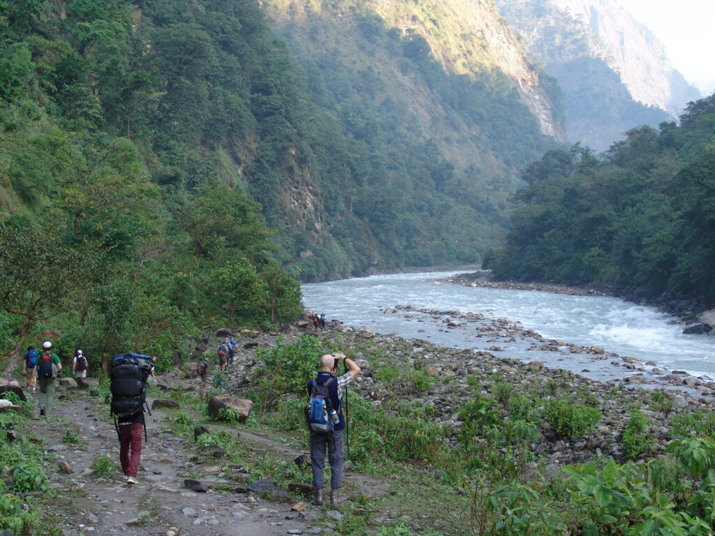
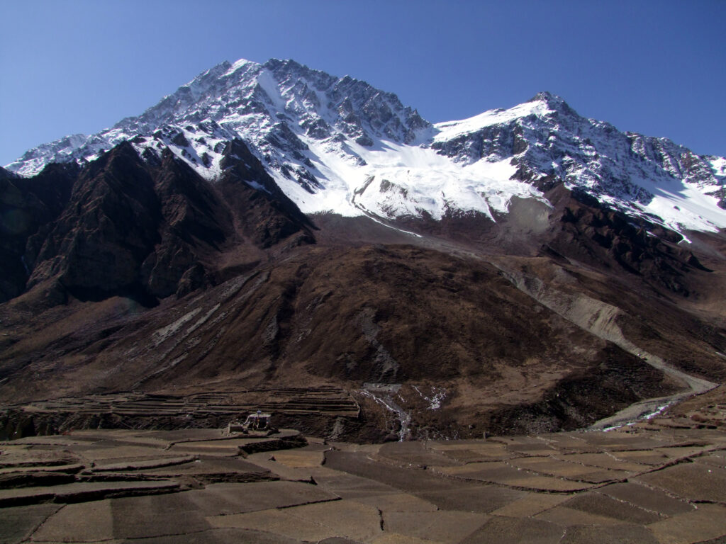
Nar Phu Valley, a restricted isolated area that remains untouched by the testament of time. The valley is located near the Nepal-China border. The settlement has a unique geography combination of high peaks and passes, glaciers, remote villages, narrow canyons, subtropical evergreen forest, stunning rock formations, yak pastures and gompas mostly influenced by Tibetan Culture. 

The government restricted foreign travelers from visiting the valley until 2002.These villages and the surrounding 7000m peaks remain virtually untouched, very few trekkers have explored these remote valley.
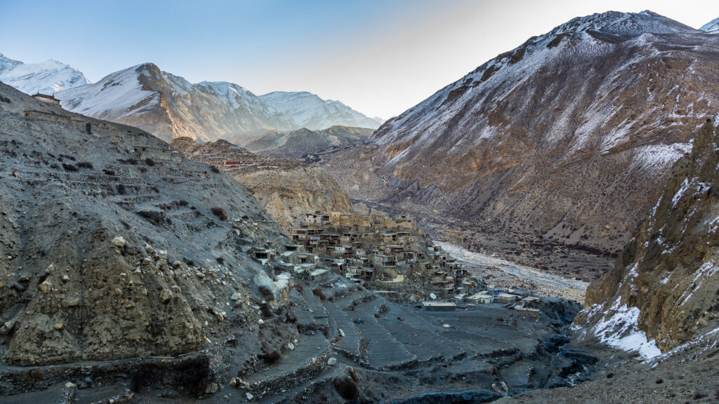
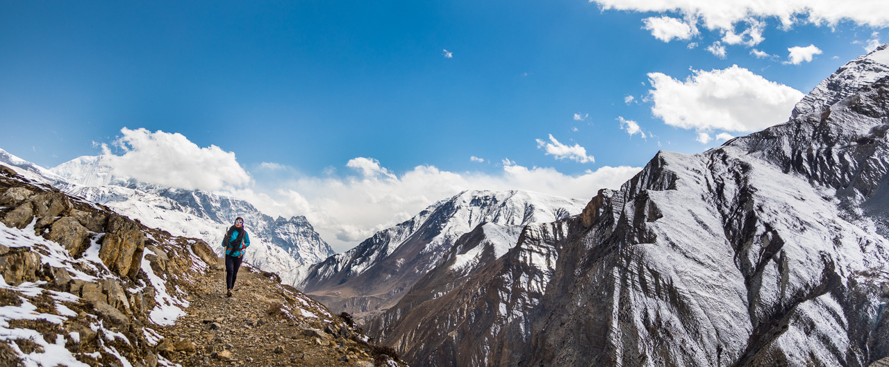
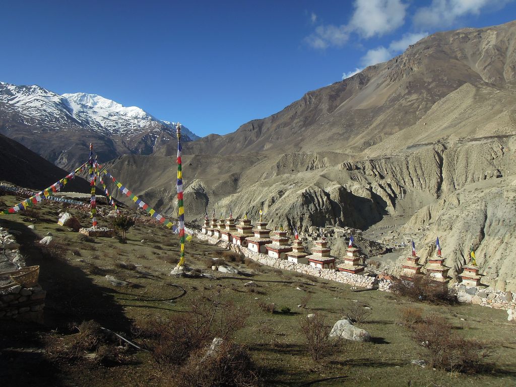
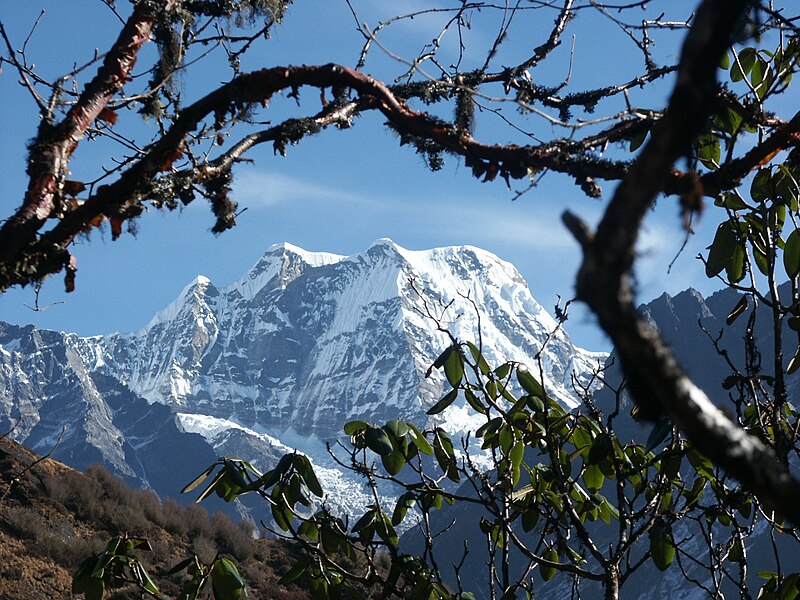
Distant view of Nar Phu Valley

If you are searching to travel to a more isolated region with a less crowded trail. This article/ blog will provide you with information and everything you need to know about the trail.

We will explore the top attractions, trekking tips, and cultural insights to help you plan a perfect trip. This guide to Narphu Valley covers scenic trails, cultural highlights & essential travel tips to make your journey unforgettable. 

Main Attractions in Nar Phu Valley 

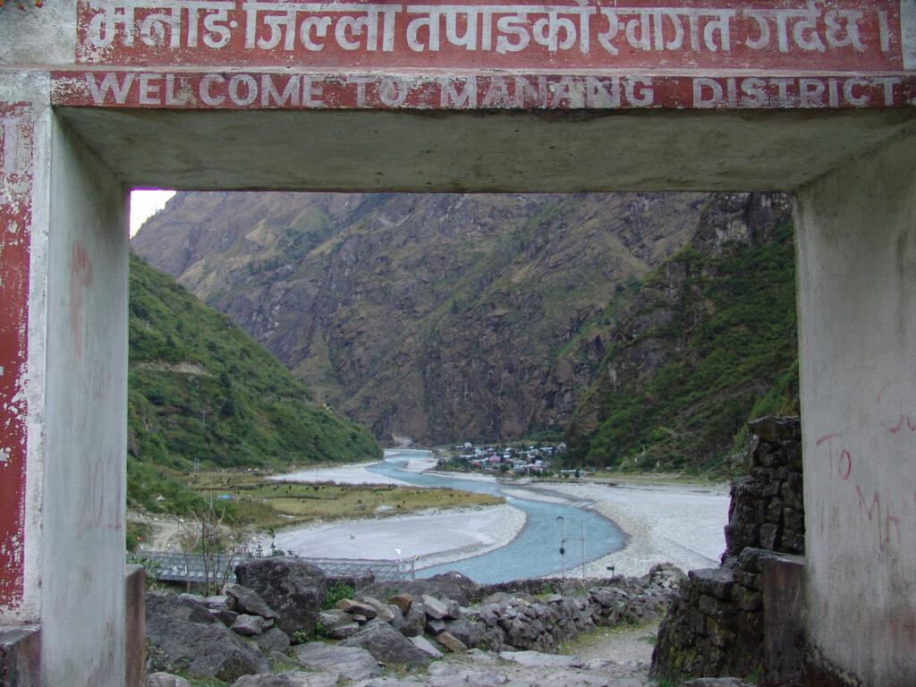
Nar Phu Valley lies in the most remote district of Manang. It is accessible only via a purchase of a special permit. Two historic village settlements, “Nar and Phu,” preserving centuries old tradtion influenced by tibetan culture form the heart of the valley.

Nar Village:

Trekkers rarely visit the village of Nar, despite its close proximity to the Annapurna circuit trail. The village has a medieval feel with its stone houses, dry farmland, and wonderfully painted, bamboo-topped chortens. The village is situated at an elevation of 4,110m above sea level. The stunning views of the surrounding peak, includes Kang Guru, and Pisang Peak. Satya Monastery monastery at Nar Phedi overlooking the valley adorned with colorful prayer flags serves as a focal point of spiritual life. Trekkers can interact with the locals and witness the local way of life in this remote part of the Himalayas, which revolves around traditional farming, yak herding, and centuries-old custom

Phu Village:

Phu village can be reached after a day’s trek from Meta. Located at 4,080m Phu Gaon is a time capsule of ancient Tibetan culture. The trail to the village is carved from the side of the mountain cliffs, trekking along the trail will give you a sense of adventure. From Phu village, witness the spectacular views of Himlung Himal and other snow-covered peaks. If you are looking for an expedition to Himlung Himal, Phu Gaon is an ideal location for acclimatization. The main attraction of the village is the centuries-old “Dzong”(Tibetan-style fortress) and the remains of two ruined forts. The Tashi Lhakhang Monastery, that sits atop the village is believed to have been blessed by renowned Buddhist Guru  Rinpoche. A culturally historic landmark built more than 200 years ago, serves as a focal point of spiritual life.

Kang La Pass:
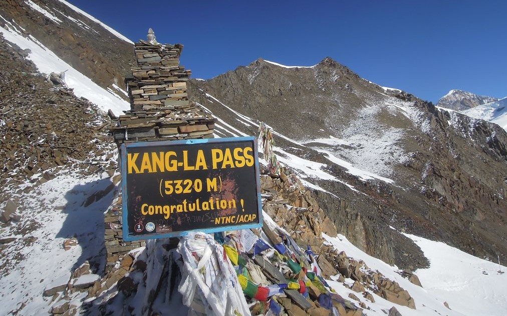
Kang-La-Pass

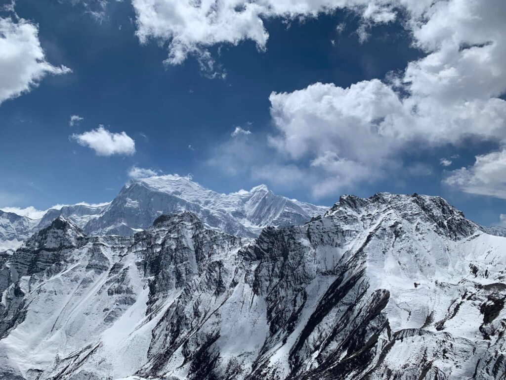
Kang La Pass (5,320 m) , the highest trekking trail in the region, grants breathtaking views of the Annapurna range. Crossing this challenging high-altitude pass is a thrilling adventure that rewards trekkers with panoramic vistas of Annapurna II, Gangapurna, and Tilicho Peak. The journey is the only trail reaching the Phu village. Kang La Pass is both challenging and exhilarating, this part of the trek is a true test of endurance offering breathtaking views and memorable experiences.

Himlung Himal Expedition:
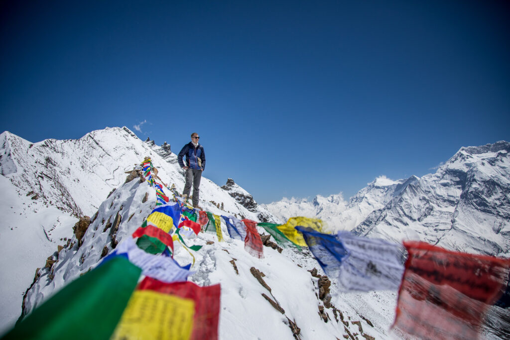
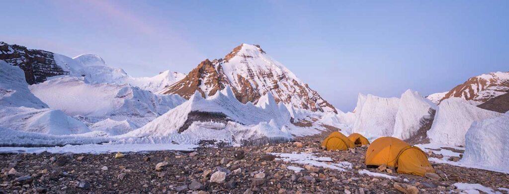
View from the Himlung Himal

Himlung Himal (7,126m) a mountain peak wedged between the Annapurna and Manaslu mountain ranges. The mountain is well within the Annapurna Conservation Area close to the Tibetan border and afar from the Annapurna Circuit trail. This mountain is an excellent choice for mountain climbers waiting to gain some experience before climbing higher peaks. Himlung Himal, this less crowded peak is a relatively straightforward climb to the summit, but in itself will give you all the thrills of a true mountain climbing expedition. The trek to Himlung Himal Base camp also passes through the Nar Phu Valley, making it an ideal destination for adventure seekers and remote travelers. There are no paved roads that lead to this region, the only way necessary goods are brought in by yak, mule, or carried by potters. At this altitude, you will find yaks grazing and Tibetan flags fluttering against the winds.  

Himlung Himal, this mini-expedition is best good practice and gaining more experience to more challenging and demanding Everest and Annapurna Himal expeditions.

Festivals and Cultural Practices in Nar Phu Valley
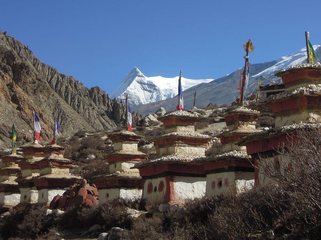
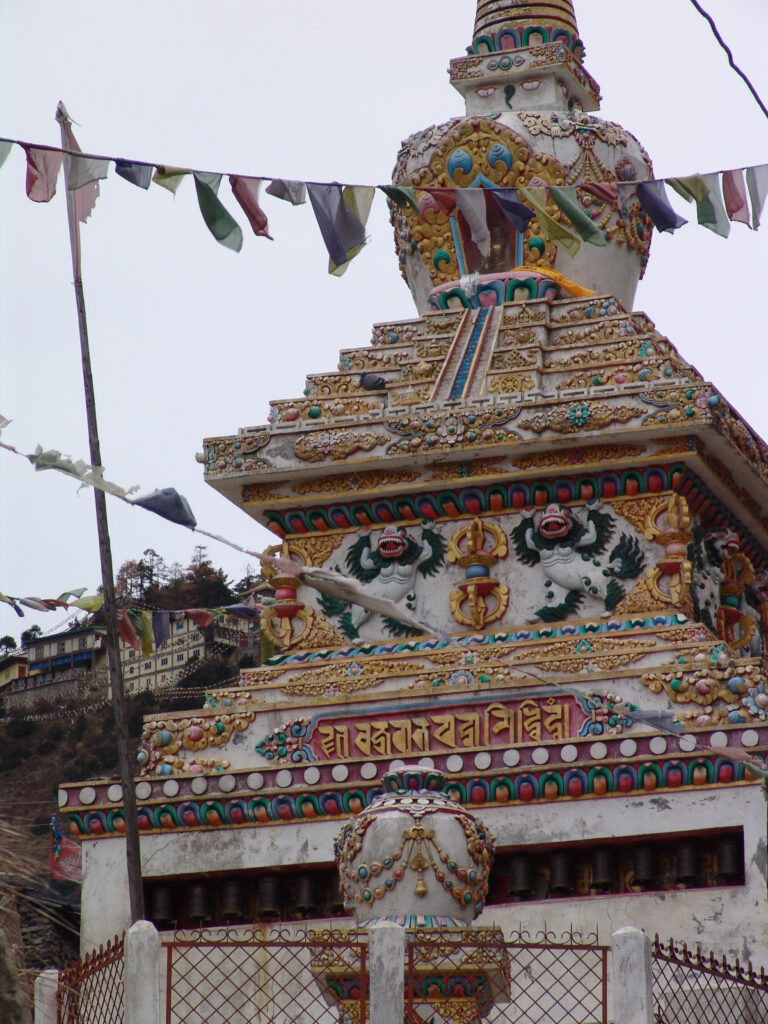
Gompas in the Narphu valley

The Nar Phu Valley remains a cultural haven, where ancient traditions and spiritual practices are still followed and preserved. Major festivals like Lhosar (Tibetan New Year), are celebrated with vibrant ceremonies, dances, and prayers. Locals also observe Saga Dawa, commemorating the life of Lord Buddha, with religious and communal gatherings. The villagers’ rich Tibetan heritage is evident in traditional attire, Tibetan dialect-influenced language, and Tibetan-influenced architecture. Visiting the region during these festive times gives an immersive experience and cultural insights into their daily lives.

Highlights of the Nar Phu Valley

  • Experience the stunning views of Annapurna, Manaslu, and Himlung Himal ranges.
  • Explore remote and unique Tibetan-influenced culture and traditional villages.
  • Trek to the Himlung base can mesmerize in the views of the panoramic Himalayan mountains.
  • Cross the challenging Kang La Pass.
  • Pay respects in Tashi Lhakhang, a centuries-old Buddhist monastery. 
  • Explore trails through remote and less-explored landscapes.
  • Spot wildlife including Himalayan black bear, blue sheep, snow leopard, and many other bird species.
  • Explore the ancient history of Nar and Phu village.

Trekking permits for Nar Phu Valley

Trekking in the Nar Phu Valley acquiring permits is necessary for travelers, as the valley lies close to the Tibetan border. Mainly two permits are mandatory while trekking in the region:

  • Restricted Area Permit (RAP)
  • Annapurna Conservation Area Permit (ACAP)

These permits are mandatory and must be processed through a registered trekking agency. Solo travelers cannot secure permits and must trek with a licensed guide or group.

Best Time to Visit the Nar Phu Valley

Nar Phu Valley is open all year round. Considering the valley to be a rain shadow area. The valley is best traveled during:

  • Spring (March to May)
  •  Autumn (September to November)

During these months, the weather is stable, the skies are clearer and the trails are in excellent condition. Also regarded as the peak tourist season. Spring brings blooming rhododendrons and vibrant landscapes, and autumn offers crips air and panoramic mountain views.

Preparation and Fitness Required
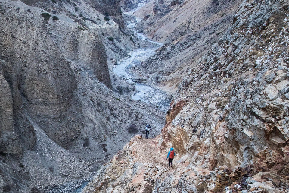
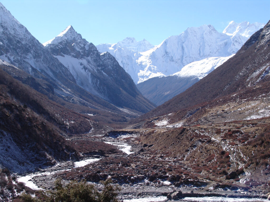
On the way to Narphu valley

Nar Phu Valley trek due to its remoteness is moderately challenging, requiring good physical fitness and prior trekking experience. Trekkers should prepare for high-altitude conditions, including acclimatization days to avoid altitude sickness, Cardiovascular endurance, strength training, and a steady hiking pace are essential for the duration of the trip. It is required to pack proper gear, including layered clothing, sturdy boots, necessary foods for the trip to ensure a comfortable trek.

Accommodation and Internet Facilities
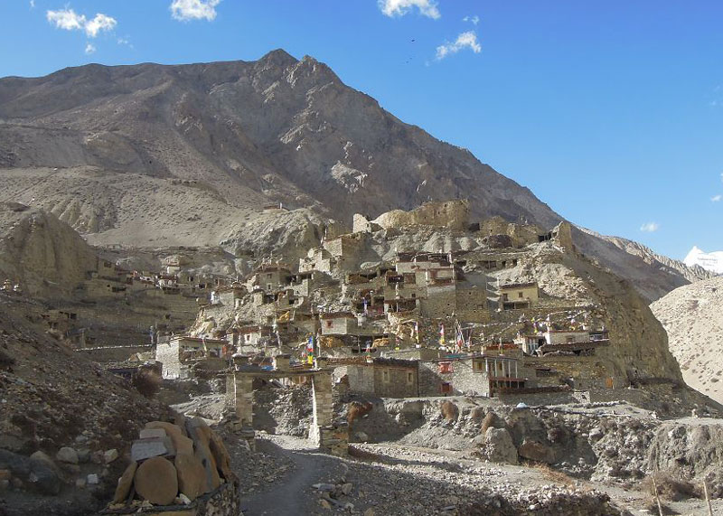
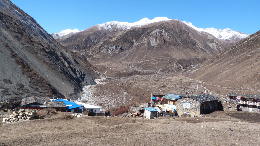
Village in Nar Phu Valley

Accommodations in Nar Phu Valley consist mainly of basic teahouses that provide nutritious meals and a warm place to rest. While the facilities are modest at best they are clean and hospitable. Internet access is available in some areas of the villages, but the connection may be slow or interrupted. Trekkers should carry a backup power source for electronic devices and prepare for limited communication. Nevertheless, these remote locations provide an opportunity to detach from the daily crowded life and let travelers have an immersive experience in the wilderness.  

Local Food During the Nar Phu Valley Trek

When it comes to food during the Nar Phu Valley trek, trekkers can expect authentic local dishes unique to this Himalayan region. In contrast, the lavish variety of dishes often seen in other parts of Nepal is less prevalent here due to the region’s remoteness. However, trekkers have the option to bring their own food and snacks. On the trail to the valley, trekkers can savor authentic Nepali and Tibetan dishes as they journey to these remote regions.People commonly serve staples like dal bhat (rice and lentils), dhido (ground buckwheat or millet), thukpa (noodle soup), and tsampa (roasted barley flour). Yak cheese, butter tea, and momos (dumplings) are also local favorites. The food is hearty and provides the energy needed for trekking. 

Modes of Transportation to Nar Phu Valley
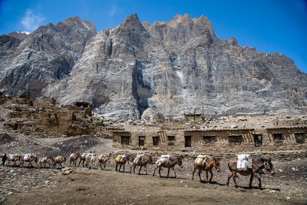
Mules transportating goods in Nar Phu Valley

The trek to Nar Phu Valley begins in Koto, accessible by a drive from Kathmandu to Besisahar and then to Meta. Public Local jeep and private jeeps are the primary modes of transportation. For those with limited time, a helicopter charter is an option to reach the starting point.

How Hard is the Nar Phu Valley Trek?

Trekkers consider the Nar Phu Valley trek to be moderate to challenging. The trails involve steep ascents, high-altitude passes (Kang La Pass), and rugged terrain. Proper acclimatization, a slow pace, and adequate preparation can make the trek manageable for physically fit individuals.

Is Solo Trekking Allowed in Nar Phu Valley?

The restricted status of the Nar Phu Valley prohibits solo trekking. Trekkers must either join a group of at least two people or hire a government-registered licensed guide to secure the required permits.This regulation ensures safety and helps preserve the region’s environment and culture.

Nar Phu Valley, a remote location, and its timeless monuments offer a unique blend of adventure, culture, and memorable scenery, making it a must-visit destination for travelers and trekking enthusiasts. Explore ancient villages, challenge yourself while crossing high-altitude passes, or delve into rich Tibetan traditions, the valley promises an unforgettable experience and countless memories that last a lifetime.

Ready to embark on your Nar Phu Valley adventure? Contact Corporate Adventure Treks today to book your trek and let us guide you through this hidden Himalayan gem!

Raunak
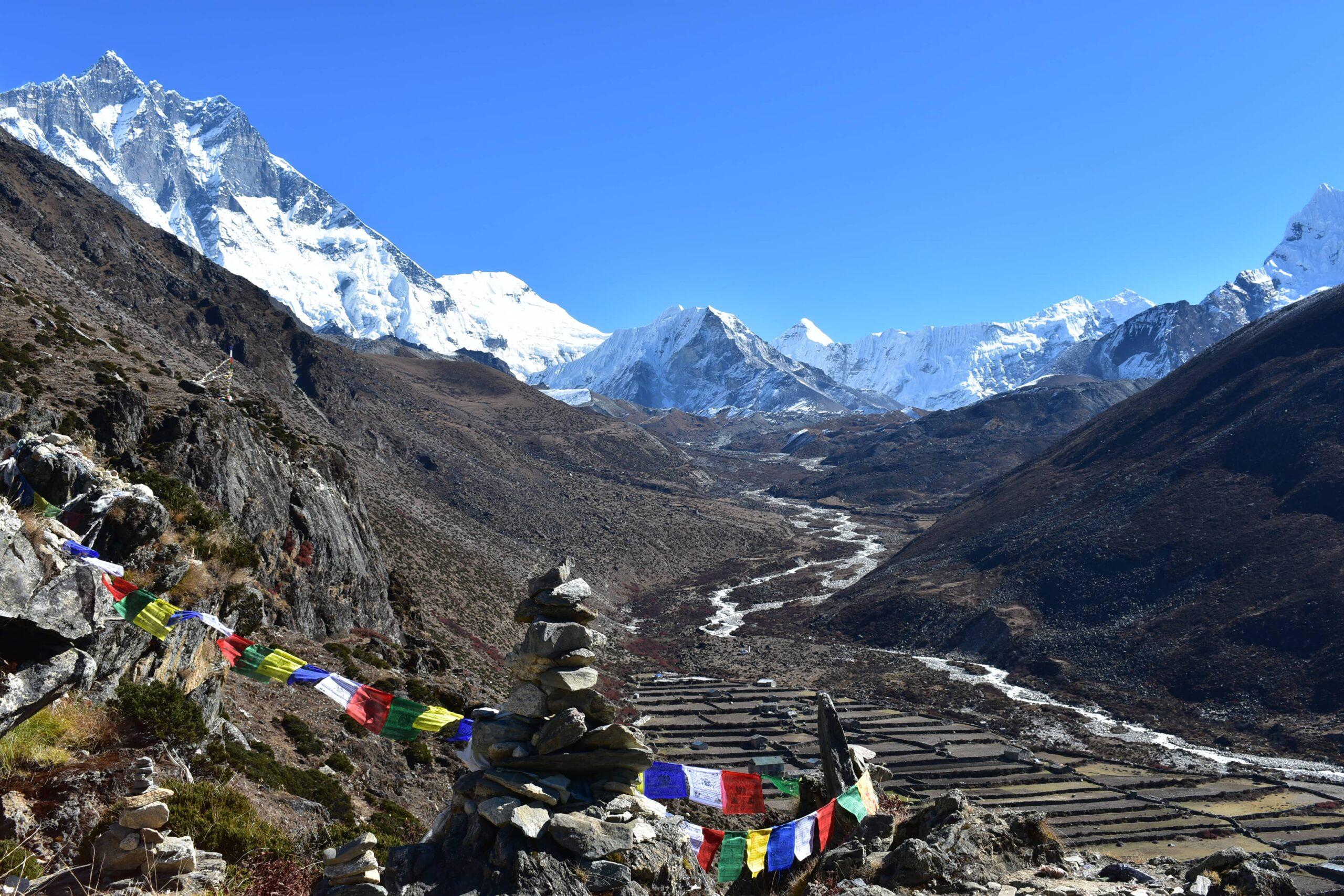
Trekking to Manaslu Region

A Complete Guide for Trekkers

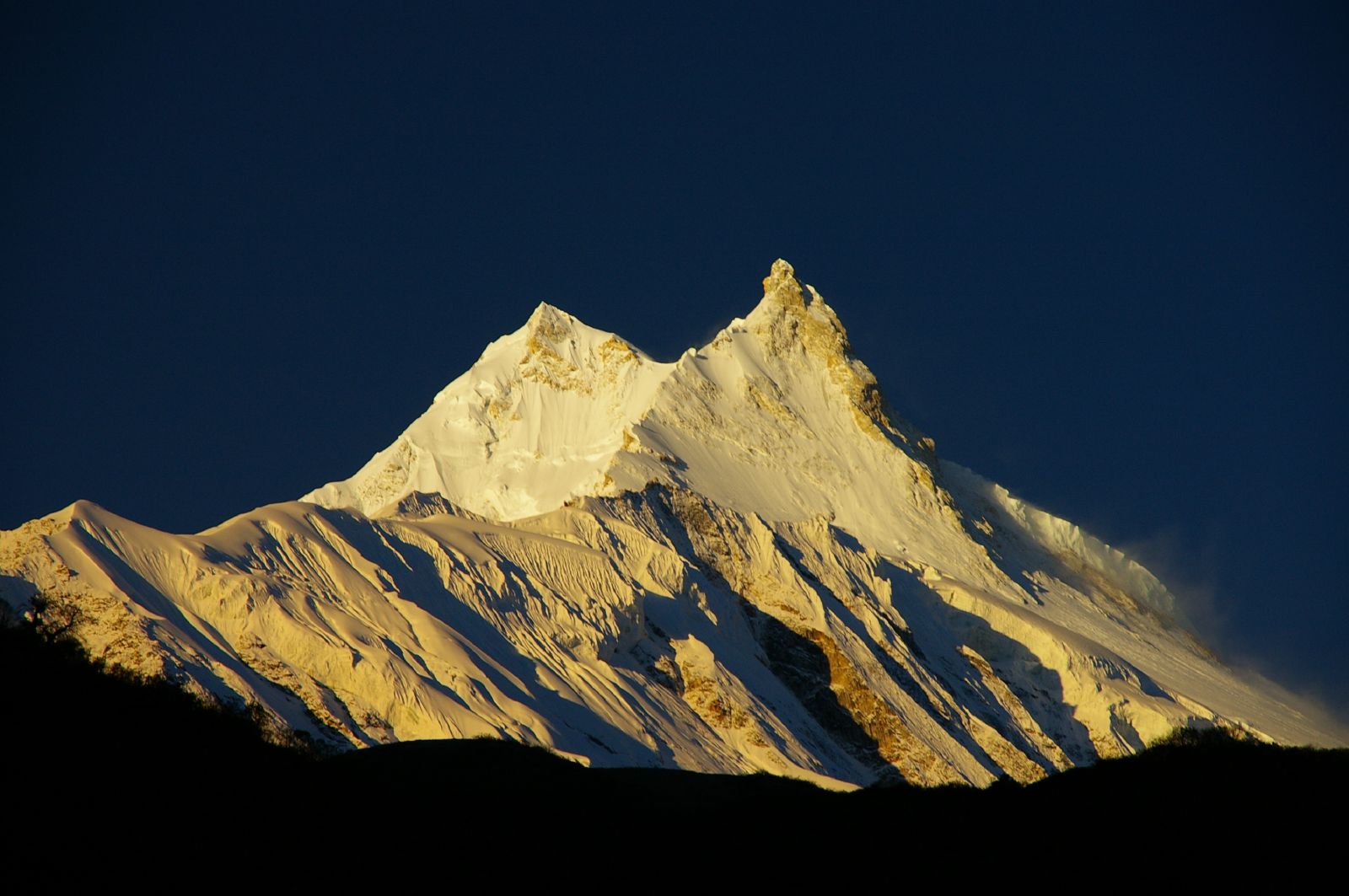
Manaslu region, a hidden gem of Nepal tucked away in the isolated part of the Himalayan mountain, near the Nepal-China border. Mount Manaslu (8,163 meters), the eighth-highest peak in the world, dominates the landscapes in this region. The mountain views of the valley have a distinctive peak with its double summit and a serrated-shaped high peak. Manaslu, which means “Spirit of the Mountain” comes from the Sanskrit word Mansa, meaning “intellect” or “soul”. The mountain was first climbed by a Japanese Expedition team led by Toshio Imanishi and Gyalzen Norbu in 1956. Trekking around the Manaslu circuit follows an ancient salt trading route along the Budi Gandaki River. 

Once a restricted area, the Manaslu region opened its borders to international trekkers in 1991 AD. The region is mostly influenced by Tibetan Buddhist culture, various monasteries, gompas, and decorative prayer flags can be seen scattered across this region. The trek follows the Budi Gandaki River, high-altitude passes like Larkya La (5,106m), and passes through traditional Tibetan Buddhist villages.

Trekking to the Manaslu region can be a great alternative to the more popular and crowded Annapurna and Everest regions. The Manaslu region has the same high mountains, Tibetan-influenced culture, various rare wildlife, and diverse flora and fauna. If you are looking for adventure wanting to explore the mountainous region with less crowded trail, the Trekking to Manaslu region is an ideal choice.

How Difficult is trekking to Manaslu region?

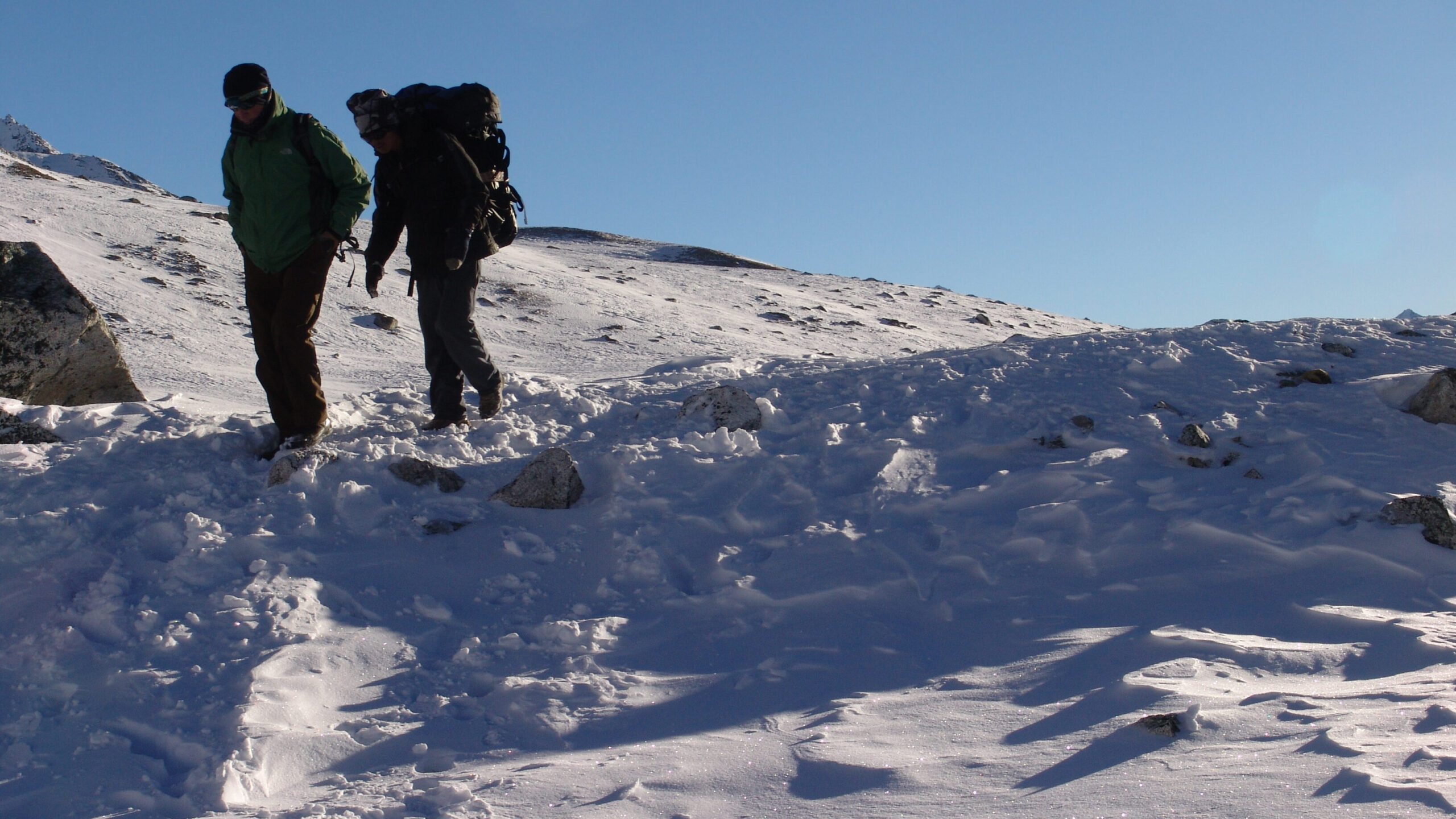
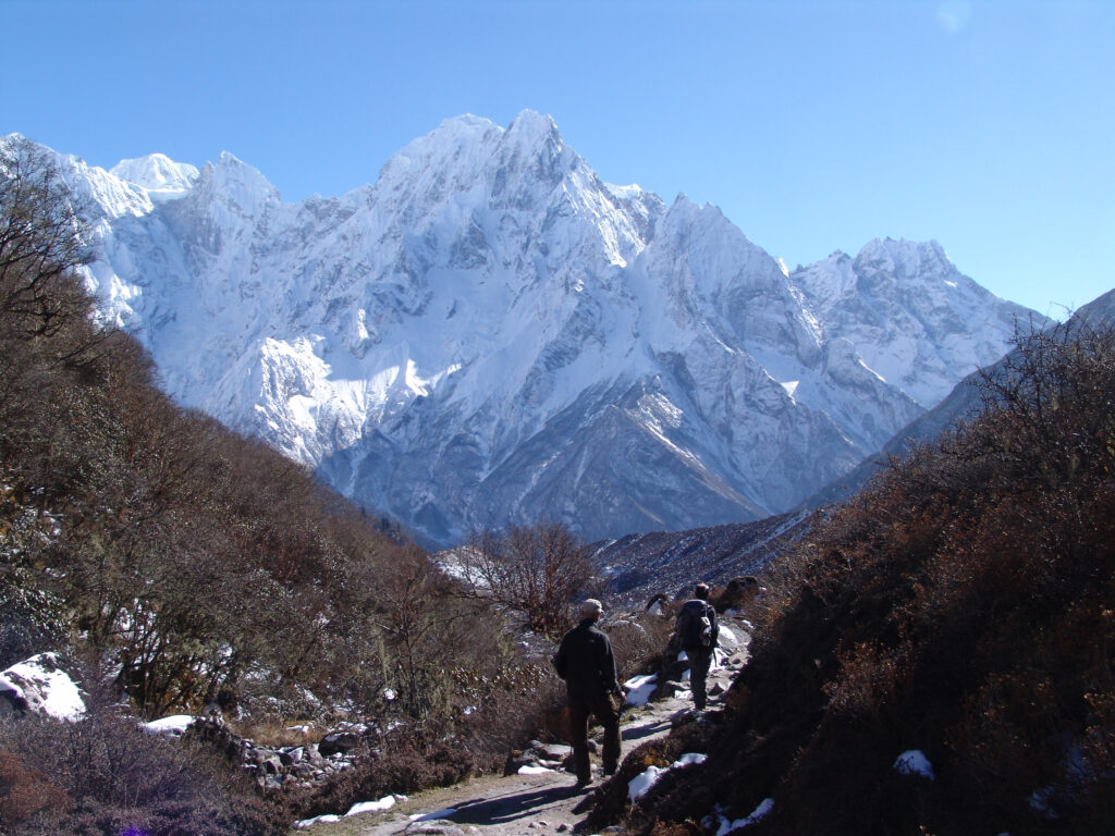
a trekker and a potter walking throught the mansalu valley

Trekking to the Manaslu region can be challenging to moderate depending on the circumstances. The trail requires a good level of physical fitness and mental preparation due to the following factors:

  • Altitude: The trek takes you to altitudes over 5,100 meters, with the highest point being Larkya La Pass (5,106 meters).
  • Long Distances: Daily hikes can last anywhere between 6 to 8 hours, covering steep ascents and descents.
  • Weather: The high-altitude climate can be unpredictable, requiring proper gear and acclimatization.
    Despite the challenges, the trek is manageable for anyone with prior trekking experience and determination. Proper acclimatization and preparation are key to success.

Highlights of the Manaslu Region

1.   Larkya La Pass:

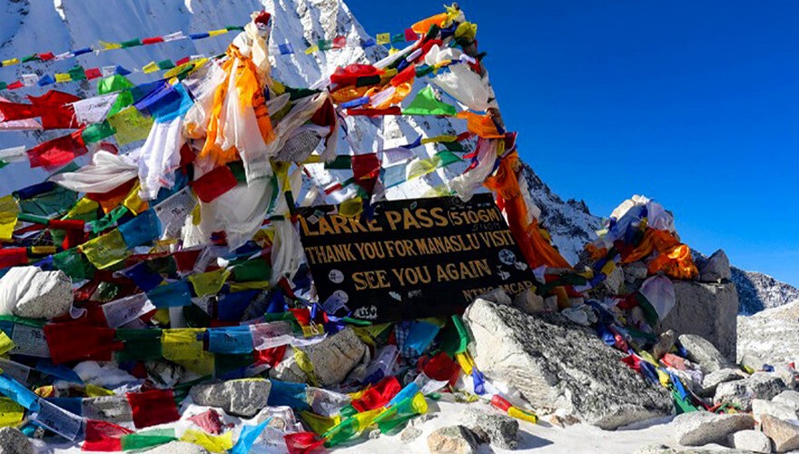
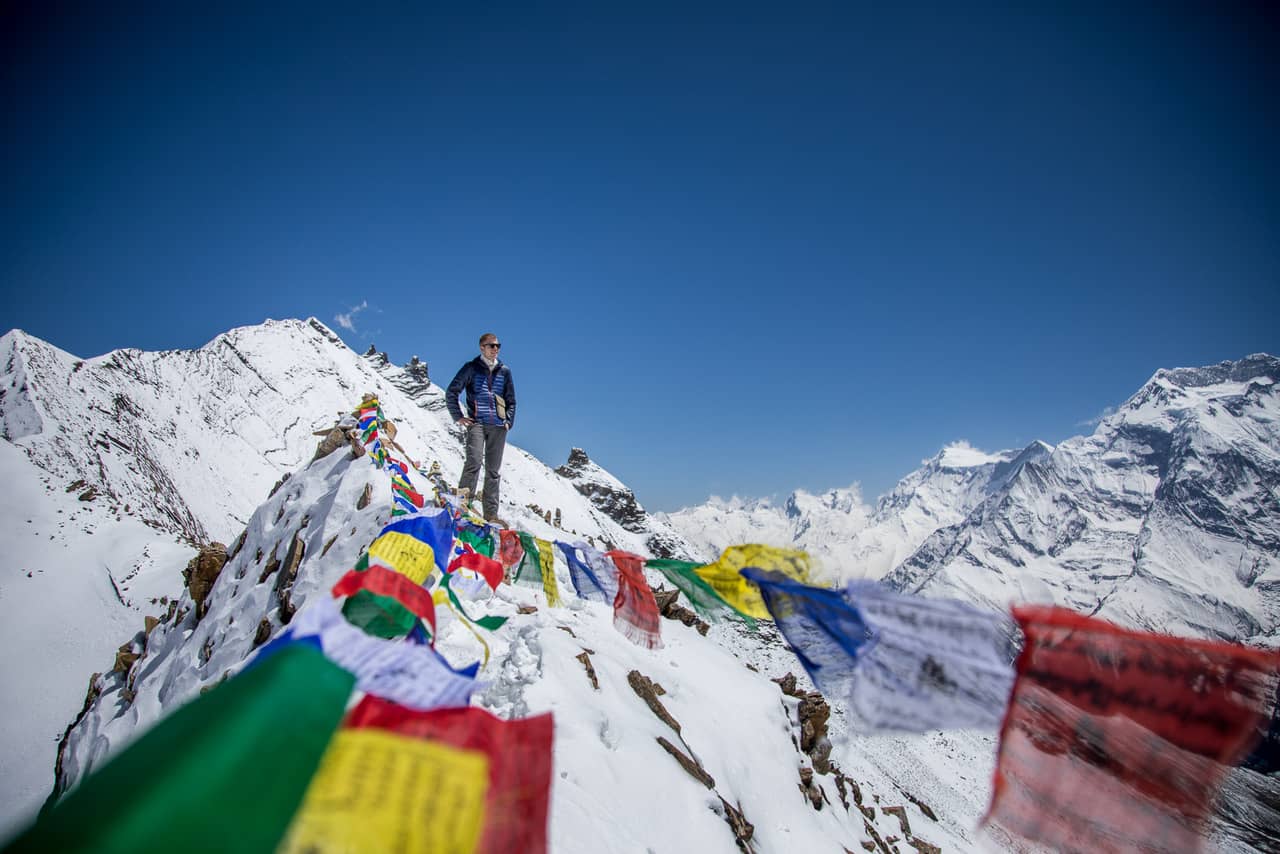
Praying flags in Larke La Pass

This is the trek’s highest and thrilling section crossing the Larkya La Pass (5,106m), which offers panoramic views of Mount Manaslu, Himlung Himal, and other snow-capped peaks.

2.   Tibetan Buddhist Culture:

Centuries old Serang Gompa, a Buddhist Gompa

Being near the Nepal-China border the Manaslu region is greatly influenced by Tibetan Buddhist culture. Serang Gompa a centuries-old monastery serves as a center for education, religious ceremonies, and meditational place for the local Tibetan Buddhist community. See the trail decorated with prayer wheels and mani walls in villages like Samagaun and Samdo, showcasing Tibetan Buddhist traditions.

3.   Side Trips:

Mini- gompas in Tsum valley

Manaslu region includes various off-trail locations like the freshwater Birendra Lake, Manaslu Base Camp, Nubri Valley, and Tsum Valley. Exploring these regions gives into an immersive experience while trekking through the valley. 

4.   Calming Landscapes

This rain shadow region has its landscapes covered in subtropical pine, grazing meadows lands, and glacial moraines. This region can be visited even during monsoon season due to the region receiving less rainfall and having a picturesque landscape.

How Much Does Trekking to Manaslu Cost?

Manaslu trek can vary depending on the services and the provided amenities chosen. There are various packages available to better suit your needs. Modifying trip packages and itineraries can be done hassle-free. Budgeting carefully, managing expenses, and choosing the right package can help manage the cost.

How Long Does Trekking To Manaslu Take?

a small settlement in Manaslu region

Trekking to the Manaslu region can take anywhere from 10 to 20 days, depending on acclimatization days and side trips. The starting point for the Manaslu region treks includes:

  • Drive from Kathmandu to Maccha Khola by jeep. (8- 10 hours)

An optional trip to Tsum, Nubri Valley, or other side trips can extend the duration to over three weeks.

Is a Guide Needed when Trekking To Manaslu Region?

Travellers passing by the Buri Gandaki River in the Manaslu Region

Yes, a guide is mandatory for the Manaslu trek. The region is classified as a restricted area, Solo trekking and trekking without a licensed guide is not permitted. Hiring a guide ensures:

  • Safety: Expertise in navigating trails and handling emergencies.
  • Environment: Trekking with a guide ensures the safety and peace of the natural habitat.
  • Cultural Insight: Deeper understanding of local customs and traditions.
  • Permit Compliance: Assistance with obtaining necessary permits.

Best Seasons for Trekking to the Manaslu Region.

Birendra Lake in Manaslu region

The ideal times to trek are:

  • Spring (March to May): The skies are clearer with blooming rhododendrons forest and moderate weather.
  • Autumn (September to November): Most preferred season due to the cultural happenings, vibrant festivals, and stable weather provide excellent visibility of the valley. 
  • Winter seasons are less favorable due to extreme cold and heavy snowfall.

What to Pack for the Manaslu Circuit Trek?

A tourist and a guide travelling to Manaslu region.

Packing the right gear is crucial for this trek. Basic items include:

  • Clothing: Thermal layers, waterproof jackets, trekking pants, and gloves.
  • Gear: A good-quality sleeping bag, trekking poles, and sturdy boots.
  • Essentials: Sunscreen, water purification tablets, first-aid kit, and energy snacks.
    Packing light but adequately ensures comfort on the trail.

Additionally, you can hire a potter for extra heavy gear.

What Permits Are Required for the Manaslu Region?

Trekking across the Manaslu region requires the following permit:

1.   Manaslu Restricted Area Permit (MRAP): Rate for the season differs upon the season. Here are the Trekking permits fees are mentioned below:-

  • September-November USD 100 per person/week (USD 15 per person/day beyond 1 week)
  • December – August USD 75 per person/week (USD 10 per person/day beyond 1 week)

2.   Manaslu Conservation Area Permit (MCAP): Costs Rs.3000/ ($30 equivalent). 

3.   Annapurna Conservation Area Permit (ACAP): RS. 3000 ($30 equivalent)

4. Local development community fee: Rs 1000 (equivalent USD10) .

These permits are obtainable through trekking agencies.

What Are the Accommodation Options in the Manaslu Region?

Tea house in Manaslu region

Manaslu region offers basic teahouse accommodations and lodge houses providing a place to rest and meals for trekkers. Options include:

  • Budget Teahouses: Basic facilities with shared rooms and bathrooms.
  • Lodge: Slightly more comfortable with private rooms and attached bathrooms in some locations.
  • Semi–Luxury: Available in some places but not all over the regions, provides more comfort, heated rooms, private baths, and internet facilities.
  • Camping: Ideal for those seeking more adventure but require additional gear and arrangements.

Conclusion

Traveling across the Manaslu Region can be quite an exhilarating experience. The thrilling adventure combined with the beauty of the region and a glimpse into the rich cultural heritage of the Himalayas can be something to remember, memories that last a lifetime. Crossing the dramatic Larkya La high pass gives an immersive panoramic view of the surrounding valleys and mountains. Being greeted by Tibetan Buddhist traditions, every step is an experience to cherish. Together with Corporate Adventure Treks, careful planning, and preparation for the Manaslu region will leave you with memories to last a lifetime. So, pack your bags, get your permits, and set out on an adventure that takes you to the hidden gem of Nepal.

Raunak
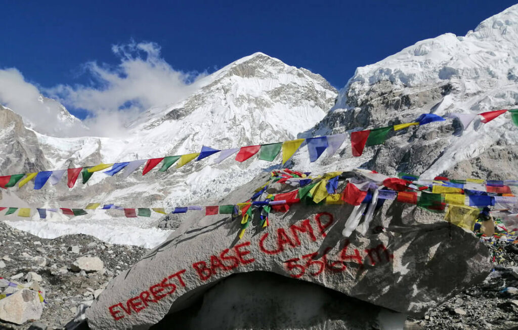
Mountain Peaks in Annapurna Region

Annapurna region is located in the center of the “Great Himalayas”. The Annapurna massif, in north-central Nepal, covers a total of 80km of land, from the Marsayangdi River to the East, the Kali Gandaki River to the west, and the Pokhara Valley to the south. Annapurna I main stands tall at 8,091m making it the 10th highest mountain in the world. Regarded as the crown jewel of the Annapurna range, Annapurna I is one of the most challenging peaks, conquered by only a few daring climbers. In 1950 AD, a French expedition team led by Maurice Herzog made the first ascent of Annapurna I, making it one of the first 8000-meter peaks to be climbed.

The Hindu deity Annapurna, the goddess of food and nourishment, gave Mt. Annapurna its name. The word Annapurna comes from the Sanskrit terms “Anna” (food) and “Purna” (filled), which translate to “Everlasting Food.”Numerous rivers and streams descend from the slopes of Annapurna Massif which provides water for the agricultural fields and grazing pastures located at lower altitudes.

The entire Annapurna Massif and the surrounding area covering 7,629m is the first and the largest conservation area in Nepal. The Annapurna Conservation Area is home to several treks, including Annapurna Sanctuary and Annapurna Circuit.

The Mountain peaks in the Annapurna region ranges from 6000m to 8000m. The following are some of the popular mountain peaks in the Annapurna region:-

Table of content:

  1. Annapurna I
  2. Annapurna II
  3. Annapurna III
  4. Annapurna IV
  5. Annapurna South 
  6. Gangapurna
  7. Hiunchuli
  8. Machhapuchchhre 
  9. Nilgiri Himal
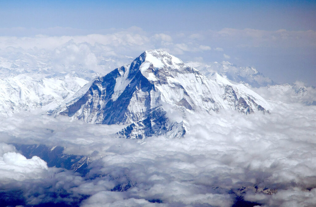
  10. Dhaulagiri

Annapurna I (8.091m | 26,545ft) : 

Annapurna I was the first 8,000m peak to be climbed in 1950 AD, by a French expedition led by Herzog. This mountain is considered one of the most challenging peaks among the 14 eight-thousanders. It lies in the east gorge cut through by the Kali Gandaki river which separates the other large massif, Dhaulagiri. The entire massif lies within the Annapurna Conservation Area Project (ACAP). The Annapurna mountain range is a chain of mountain peaks that shares its name. The peaks include Annapurna I, II, III, IV, and Annapurna South. Unlike other 8000ers Annapurnas barely stands out as most of it is hidden by other peaks surrounding it.

Annapurna II : (7,937m | 26,040 ft)

Annapurna II is the 2nd highest mountain peak in Annapurna region. The rugged terrain has some extremely difficult climbing routes that require advanced skills and experience making it challenging for many climbers. It varies from steep glacial ridges and rocky faces to snow fields. There are some amazing views from trails, like the Annapurna Circuit, that take you around Annapurna II. Annapurna II, though challenging the mountain has some scenic beauty surrounding land and culture that make this part of the Himalayan range a real treasure.

Annapurna III : (7,555m | 24,786 ft)

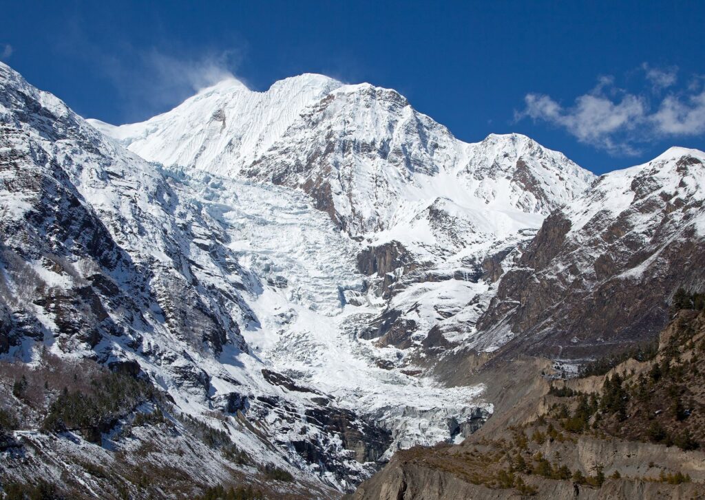
Mt. Annapurna III

Annapurna III the third mountain peak of the Massif rises 7,555 meters in height, a peak in Nepal’s Annapurna Region dominating the landscape located within the Annapurna Conservation Area. the striking pyramid shape a key attractions for trekkers on the Annapurna Circuit. 

Climbing Annapurna III can be quite challenging because of the steep ridges and uncharted weather, which require technical ice climbing. Compared to other peaks in the massif, there have been few successful climbs. For adventure-loving travelers, Annapurna III is a place where one can witness the rugged beauty and challenges of the Himalayas. 

Annapurna IV : (7,525m | 24,688ft)

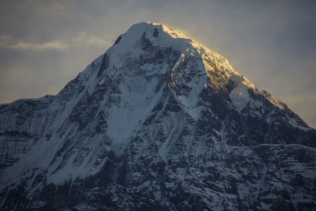
Mt. Annapurna IV

Annapurna IV is the fourth mountain peak in the Annapurna Region, with an altitude of only 7,525 meters. This part of the Massif is distinctive with symmetrical ridges and an undisturbed snow bed. The area surrounding Annapurna IV is a picturesque destination as pe peak climbers. The surrounding views include green valleys, steep alpine slopes, and icy glaciers.

Climbing Annapurna IV is very challenging requiring advanced mountaineering skills. The trail includes sections like technical ridges,  climbing on ice walls, and unpredictable weather changes. While less famous than Annapurna I, Annapurna IV will surely remain a prime destination for Himalayan adventure seekers. 

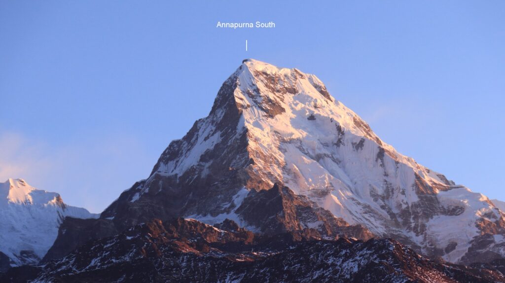
Annapurna South: (7,219m | 23,684ft)

Mt. Annapurna South

Annapurna South is located in the southernmost part of the Annapurna massif. The mountain peak is the highlight of the Annapurna Base Camp. The terrain surrounding Annapurna South features dense rhododendron forest, terraced fields, and steep rocky mountains transitioning into icy glaciers at higher altitudes.

Though not as technically demanding as Annapurna I, scaling Annapurna South poses its challenges including high cliffs, rocky trails, and undenounced weather. The challenging trek can be equally rewarding as it gives a different view of the Annapurna region.

Gangapurna: ( 7,455m | 24,457ft)

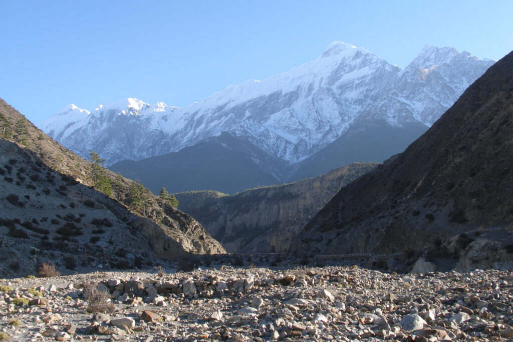
Mt. Gangapurna

Gangapurna is the part of Annapurna mountain range located in north-central Nepal. And also located in Annapurna Conservation Area (ACAP) . It was first ascended in 1965 by a German expedition team via its south face and east ridge. 

The mountain is named after the Hindu goddess “Ganga” who is a personification of  the river Ganges. The glaciers of Gangapurna, Annapurna IV, Khangsar Kang and Glacier Dom create Gangapurna Lake. Majestic mountain peak of Gangapurna can be seen from Manang Valley with breathtaking views of the Annapurna mountain  range then ascending high above Marshyangdi valley. It is on the main ridge that connects Annapurna I. 

Hiunchuli : (6,441m | 21,132ft)

Mt. Hiunchuli

Hiunchuli mountain is an extension of the Annapurna South peak. Between Machapuchare and Annapurna south lies a narrow section of the Modi Khola valley that represents the sole access to the Annapurna Santuary.

The peak was first climbed by an expedition led by the U.S Peace Corps in October of 1971 A.D. Classified as a trekking peak by Nepal Mountaineering Association, the peak is considerable difficult to ascent due to dangers from rock falls and crevases in the glaciers. The most common trail to the summit is via the Southeast face or the Northwest Face. 

Machapuchare : (6,993m | 22,943ft)

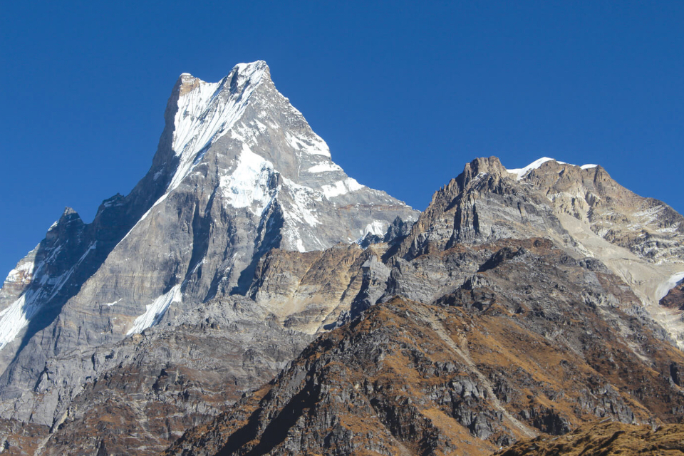
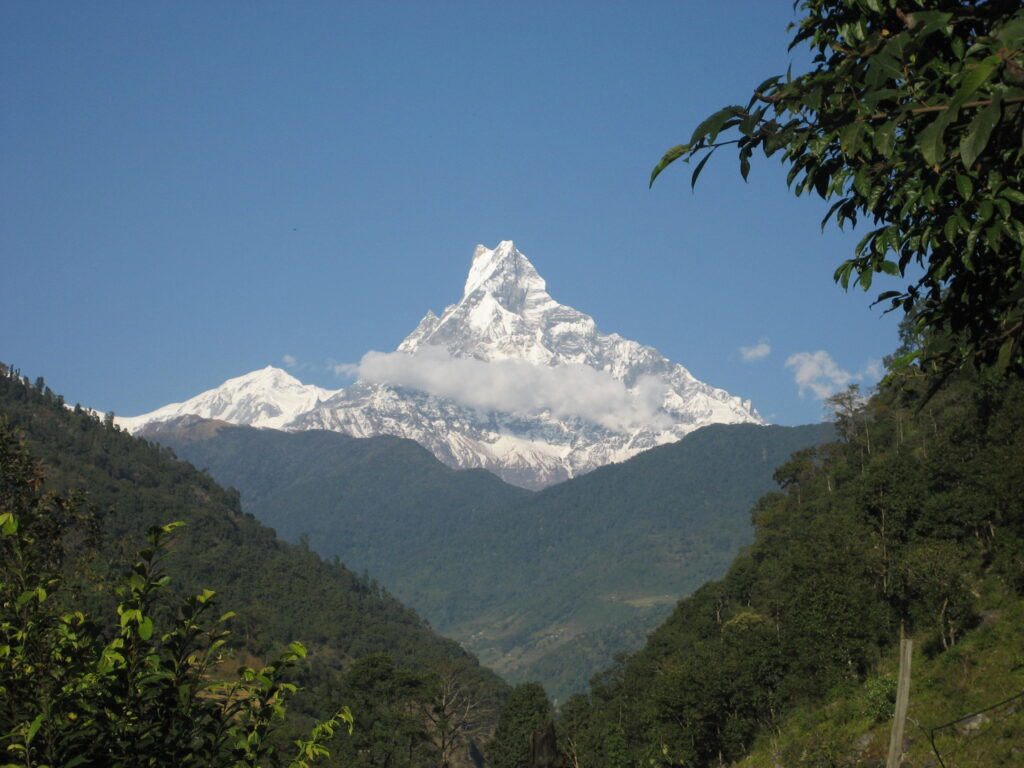
Mt. Fishtail (Machapuchre Himal)

Machapuchre himal (Mt. Fishtail) an iconic mountain situated in the annapurna region, named after its resemblance to a fish-tail. The mountain has never been officially climbed due unattainable trekking permits from the government and rightfully so, as the mountain peak is sacred to the Chomrong and Gurung people. According tot the hindu culture the mountain peak is also said to be the home of Lord shiva, protector of the region. The summit of machapuchare himal is among the few unclimbed mountain of the Greater Himalayas.

The peak being close to Pokhara city the iconic fishtail mountain dominates the skyline, unlike the peaks further away. There are various view point around Pokhara, such as Poon Hill offering stunning closeup view of Machapuchare mountain. These view points allows you to admire the panoramic views of the Annapurna mountain range without having to trek to the mountain peaks.

Nilgiri Himal (7,061m | 23,166ft)

Nilgiri Himal another peak of the Annapurana Massif is composed of three peaks Niligiri North (7,061m), Nilgiri Central (6,940m) and Niligiri South (6,839m). Niligiri Himal is located near thre Kali Gandaki Gorge and close to Jomsom. The mountain peak lies within the annapurna conservation area and are clearly visible along the Annapurna Circuit Trek.

Trekking to Niligir Himal can be technically due to its steep ridges, unpredectiable weather and snowy rocky slopes at higher altitudes.  The highest peak of Niligiri Himal, Nilgiri north (7,061m) was successfully climbed  by Kees Egeler along with five geologist, a doctor and three other. This was the first Himalayan expedition for the Dutch.

The other mountain peak, Nilgiri South (6,839m) was successfully climbed by a Japanese team from Shinshu University in Autumn of 1978 AD. 

Mountain climbers rarely try to summit this peak due to its difficult terrain and unforgiving weather. To this day 16 expedition have been attempted, with 7 successful climbs officially recorded. 

Dhaulagiri: (8,167m | 26,795ft)

Dhaulagiri mountain is one of the 8000ers and the seventh highest mountain in the world and the highest mountain peak within the borders of a single country. The first successful attempt was made by a Swiss-Austrain-Nepali expedition team in May of 1960AD. Located in South-east from Pokhara city. Annapurna I and Dhaulagiri is separated the Kali Gandaki river that flows through the Kaligandaki Gorge, the deepest gorge in the world. 

Due to its difficult terrain and acute weather conditions commercial expedition teams rarely make attempts to the summit. Many experienced mountaineers have tried to scale the peak, with few successful attempts to their names. Many have attempted to climb the mountain, a challenge not for the faint-hearted.

The peak of Dhaulagiri and Everest are composed of limestone and dolomite formed at the bottom of the ocean. Other eight-thousanders in the Himalayas are made of granite, formed deep underground. This geological evidence supports the theory that the Indian subcontient collided with th Eurasian plate, forming the “Great Hinalayan Mountain Range”.

Peak Climbing in Nepal

Searching for the best destination for peak climbing in Nepal? Trying to figure out the right peak to scale among the many Himalayan peaks? Well, look no further! We have created a list designed to answer your curiosity about the various Himalayan peaks in Nepal. Subsequently, helping you select the peak you are looking for. Even if you are trekking in the Himalayas, this article will help you know about the mountain peaks on your trail. 

Peak climbing in Nepal first opened its doors in 1949 AD and became more popular among trekkers and expedition climbers after the famous accent of Mt. Everest by Sir Edmund Hilary and Tenzing Norgay Sherpa in 1953. Peak climbing in Nepal has many favored destinations, with over 326 peaks now open for trekkers and climbers. Mountains as high as 4000m and over 8000m are waiting to be explored and conquered. 

Mountain peaks that are under 6,500m fall under the category of “Peak Climbing” or “ Trekking Peaks” as classified by Nepal Mountain Association (NMA). Nepal has over 1,310 high mountains some of which are climbable and some which have deep roots in the culture of Nepalese people. As mentioned above the peaks under 6,000m can be climbed as normal trekking trips. However, scaling the peak requires a separate permit fee. 

Most of the 6,000m peaks ranging from 6000m to 6,999m are easily scalable as compared to the challenging 8,000m ones. 6000m peak climbing is less strenuous and can easily be achieved by novice trekkers/climbers. Being physically fit with a sound health condition will help you climb these peaks with ease. Below we have mentioned the most popular peak-climbing destinations for destination in Nepal. 

  1. Island Peak 
  2. Mera Peak
  3. Lobuche East Peak
  4. Chulu Far West/ East Peak
  5. Naya Kanga
  6. Pisang Peak
  7. Gangala Peak
  1. Island Peak (6,189m | 20,305ft)
View of Island peak with rolling clouds

Island Peak, known as Imja Tse in the local language, is a mountain located in Sagarmatha National Park. The peak was named by the British expedition team due to its appearance as an island in a sea of ice when viewed from Dingboche. The southwest summit of the island peak was first climbed in 1953 as a part of the training exercise to climb Mount Everest led by a British Expedition team.

Island Peak is one of the most popular climbing peaks in the Himalayas. From the summit, you will be greeted with views of the highest mountains like Lhotse, Makalu, Cho-Oyu, and Mt. Everest. While climbing the peak you can make a nearby ascent to Kala Patthar and an optional trip to Everest Base Camp.

  1. Mera Peak ( 6,476m | 21,247ft)
Glimpse of Mera Peak

Mera Peak is another popular peak with an altitude of over 6000m. Though being at a higher altitude, the climb to the summit is relatively easier due to its straightforward trail and gentle slopes. 

However, the only issue you may encounter is improper acclimatization and sometimes bad weather especially during off-seasons. Other than that you will be able to see some of the best views from the summit.

  1. Lobuche East Peak (6,119m | 20,070ft)
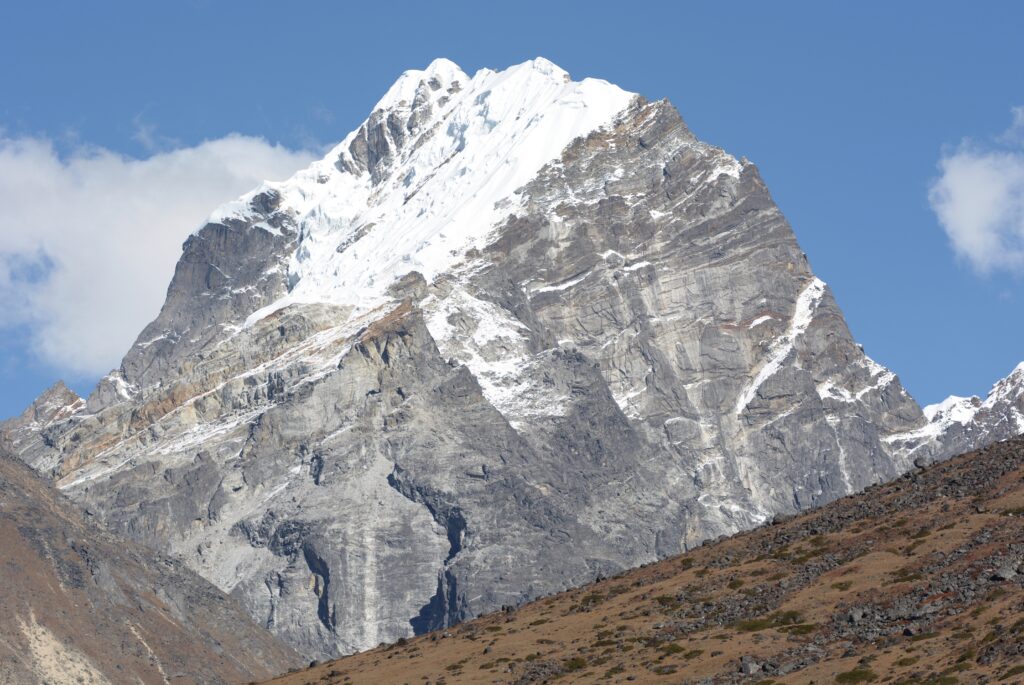
Peak view of Lobuche East Peak

Lobuche Peak consists of two separate peaks Lobuche Far East and Lobuche East. This is yet another high peak located in the Khumbu region near the iconic Everest Base camp. Though it may seem challenging due to its technical sections such as snow slopes and rocky ridges, requiring the use of crampons, ropes, and ice axes. The unparalleled panoramic views of the Himalayan mountains will be well worth the climb. Lobuche Peak is an excellent choice for beginners looking for some challenge. 

  1. Chulu Far East/ West Peak (6,419m | 21,055ft)
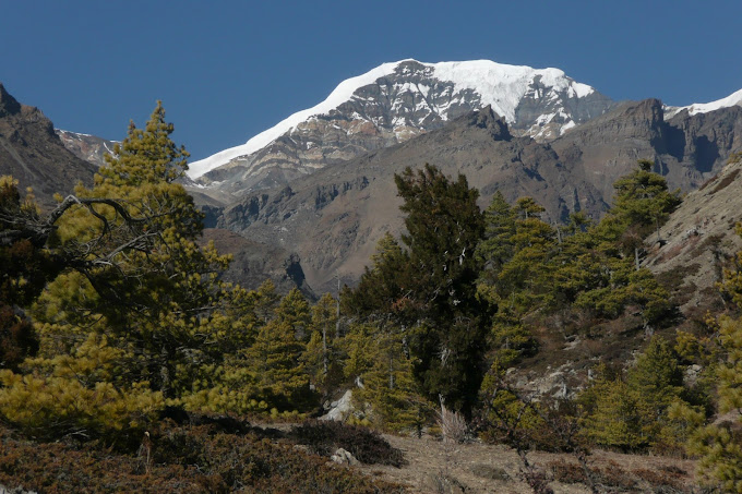
Chulu far East/ West peak

The Chulu Peak is located slightly off the Annapurna trail close to the Throng La Pass. This peak is technically more demanding, requiring a longer hike, and involves setting up two high camps before reaching the summit.

This peak is recommended for experienced trekkers with great physical condition. Despite the challenging ascent, the view from the summit is equally rewarding as you can see the entire Annapurna and Dhaulagiri mountain range along with the view of Tibet and China to the north. 

  1. Naya Kanga ( 5,846m | 19,179 ft) 
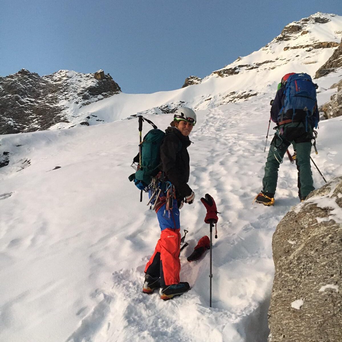
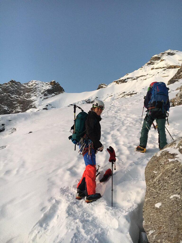
climbing start
Test of the Nayakang peak start

Naya Kanga also known as Ganjala Chuli lies in the Langtang region. The peak is short but tricky which requires technical climbing skills. The trail is relatively straightforward, but there is one small rocky section with steep snowy slopes requiring technical skill.

Naya Kanga is the shortest peak climbing in Nepal located in the southern range of Langtang Valley, inside the second largest national park in Nepal north of Kathmandu. From the summit, you will be able to view Langtang II 6596m, Lirung 7246m to the north, Shisapangma 8035m, to the northeast, and the nearby Ganja La 5122m to the east.

  1. Pisang Peak (6091m | 19,984ft)

Pisang Peak lies north of Manang Valley, passing through the famous Annapurna Circuit Trek. The climb to the peak requires proper acclimatization can be done via the west ridge. The ascent to the high camp, 5,200m is difficult to climb, especially during monsoon and winter. Prior experience is recommended due to its snowy and slippery trail. Novice climbers may feel comfortable climbing the nearby Chulu Far East or the Island Peak. The fabulous views of Manang Valley and Annapurna Range can be seen from the summit.

  1. Saribung Peak (6346m | 20,761ft) 
Saribung Peak

Though climbing to Saribung Peak started recently, it is quite popular among climbers. The peak is located in the isolated part of the Mustang region close to the border of China. The trail leads you to high cliffs, rugged terrain, and snowy mountain slopes. Climbing the peak requires reasonable physical fitness and prior experience. From the peak of the summit, you will be able to witness stunning mountains like Nilgiri (7,061m), Himlung (7,126m), Lamjung Himal (6,983m), Mt. Manaslu (8,156m) and Annapurna II (7,937m). Due to the high altitude of the peak, proper acclimatization is recommended. 

The Nepalese Himalayan mountain range gives you an array of choices that suit your needs, fitness level, skill, and experience not found in any other part of the world. If you are in search of an adventurous journey and want to experience the thrill of peak climbing in Nepal, Book your adventures with Corporate Adventure Treks!

Ultimate Guide to Everest Region

Everest Region is unrivaled in its towering majestic mountain peaks. Known also as the Khumbu region, situated in the northeastern side of Nepal. Numerous routes are available in the Everest region that ultimately lead to Everest Base Camp. Taking remote paths, and side trails is a great way to explore the region. 

Regardless of the route you follow, each offers immersive views and unique beauty of the region.

Why visit the Everest region?

The breathtaking natural wonders of the Himalayan mountains. The Khumbu ice falls, glaciers, unique wildlife, diverse flora and fauna, the Sherpa culture, and the way of life in the Himalayas make this place a must-visit once-in-a-lifetime experience. 

List of major sites you can see while on your journey to Everest.

  1. Sunrise and Sunset views throughout the various viewpoints along the route.
  2. Unique wildlife, diverse flora and fauna inside the Sagarmatha National Park.
  3. Sherpa Culture, descendant of Tibetan Buddhism characterized by strong family ties, hospitality, and hard work. 
  4. Peak climbing in the Everest region can be the most physically demanding and rewarding a person can undertake.
  5. Colorful prayer flags and ancient monasteries offer a glimpse into the history and tradition of this region.

Journeying to the Everest Region allows you to gain a new perspective in life, make memories with fellow travelers, and have a deeper appreciation for the natural wonders of our world. 

Everest region altitude.

Every valley, lake, peaks, and trail to the base camp starts from Lukla. Lukla is a small town at an altitude of 2,860m, here lies the only airport accessible in this region. 

The most challenging part while trekking to Everest is probably the higher altitude of the region. The trek starts from Lukla which is situated at an elevation of 2,860m. All the treks to the valley, lakes, peak, and the trail to base camp start from here, which is why Lukla is known as the “Gateway of Everest”. Most people are not used to this higher altitude, the  trek upwards involves acclimatization days for getting used to the altitude. The trek upward can take longer and slower for needing to rest and get acclimatized to the altitude. It is recommended to rest and get acclimatized for 2-3 days as you gain elevation.

How to get to Everest?

The journey to the Everest region first starts from Lukla, the “Gateway to Everest”. Lukla is a small town in the Solukhumbu District famous among trekkers. Here you can find the world’s highest airport which is also regarded as the world’s most dangerous one. The thrill of the adventure to Everest with a flight to Lukla airport.  

However, if you have more time and choose not to take a flight to Lukla there is an alternative route via land which is the oldest and the longest route to Everest. 

By Flight: 

From Kathmandu: The shortest and easiest way to reach Lukla is via a flight which takes about 30-35 minutes from Kathmandu domestic airport. While on the flight if the weather is clear you will be able to enjoy the panoramic mountain views of the Himalayas. 

From Manthali: An alternative route via Manthali airport, Ramechapp is available during the peak seasons and heavy traffic in Kathmandu Airport. The Airport lies 132km from Kathmandu which takes 4 to 5 hours to reach. A flight from Manthali Airport takes 15-20 minutes to reach Lukla.  

By Land:

If you choose not to take a flight, there is an alternative route to reach Lukla by bus/jeep via the motor route which goes from Jiri- Shivlaya, and  Salleri- Phaplu. The trail from Jiri to Lukla is the same trail that was used by Tenzing Norway Sherpa and Sir Edmund Hillary as they made their way to Everest 60 years ago. Salleri which is called Lower Everest region is a connecting path to Lukla via Jiri. Trekking to Salleri might seem longer but you will be rewarded with incredible views of the landscapes and mountains along the way. 

When is the best time to travel to the Everest region?

Traveling to the Everest region can be done during all seasons. Each season provides a unique experience and ever-changing landscapes. Planning the right season for your trek can enhance your experience significantly. However, traveling during each season has its pros and cons. Below are the seasons that you may choose according to your vacation while planning a trip to Everest.  

· Spring (March to May): 

Spring season offers the best visibility. The weather is mild with clear skies, and the blooming red rhododendrons forest covers the landscapes with vibrant colors perfect for photography and sightseeing. Temperatures are generally warm during the day and the view is spectacular. However, being the best and peak season for trekking, the region tends to get reasonably crowded. 

· Monsoon (June to August): 

Trekking during the monsoon season can be quite challenging. As the trails tend to get more muddy and slippery. The biggest challenge during this time is getting in and out of Lukla. Due to less visibility during this time, flights to Lukla hardly come by. While on the trail on the lower part of the trail you could experience torrential rain. 

The monsoon season is considered off-season, allowing you to trek more peacefully with fewer people on the trail. Furthermore, you will be treated to spectacular views of the Himalayan range after the monsoon morning.

· Autumn ( September to November): 

Autumn offers the best trekking conditions. During this season the temperatures are bearable with clearer skies with less chance of heavy rainfall. After the monsoon season, the air is fresh and the skies are usually clear providing unobstructed mountain views. However, late November and December can be colder than spring, this is an acceptable trade-off as the skies are clear offering great visibility. 

· Winter ( December to February):

Winter is also considered an off-season while traveling to the Everest region. This region sees some of the coldest days with temperatures dropping as low as -5° to -20°C. 

Trekking during this time can be challenging, but not impossible. Many trekkers and enthusiasts have successfully climbed during this season. From mid-January to February this region experiences more snow and a significant drop in temperature.  

Accommodation in Everest region:

There are a variety of accommodations one can find during trekking in the Everest region. Each place differs in terms of quality and range of available services. Pricing, food, and accommodation can differ as you trek to higher altitudes. Below is the list of accommodations and available amenities in the Everest Region.

· Luxury Hotels: 

Luxury hotels can be the best way to experience your trip while traveling across Everest. These hotels include state of the art facilities with remarkable views of the Himalayan mountains. You can find wide rooms with attached bathrooms and access to hot showers anytime during your stay. 

Heaters are placed in every room along with unlimited boiled and filtered water. These accommodations are known for their hygienic meals, well-maintained rooms, safety, and security. 

However, you can find luxury hotels only up to Tengboche. The accommodation onwards tends to get sparse. 

· Basic lodges and tea houses:

Tea houses and lodges are more popular with budget travelers and easily found across the Everest region. They offer necessary and basic amenities with minimal facilities like a wooden bed, blanket pillows, lukewarm or boiled water, and a common shared bathroom. Most of the lodges are handled by local people aiming to provide the basic facilities to travelers. 

These lodges are best for budget travelers and solo travelers alike.

· Tented Camps:

When trekking up to Everest Base camp was in its initial days, there weren’t enough lodges and guesthouses for trekkers. Trekkers stay at Tent Camps as accommodation. Recently due to the flourishing of tourism in the Everest region, many guesthouses and lodges can be easily found with better accommodation and necessary amenities. So, trekkers prefer to stay in these lodges. 

However, if the trekkers prefer to stay at tented camps it is available on clients demand.

Locals in Khumbu Region

Sherpas are the primary inhabitants of this region known for their warm hospitality, kindness, resilience, and unique culture. The Sherpas are of Tibetan descent and speak their language called ‘Sherpa’ which is a closely related form of the Tibetan spoken in Tibet. Here’s what you can expect while on Everest in terms of interaction and cultural insights:

  • Genuine Hospitality: The Sherpas are known for their warm hospitality and humble nature. They welcome visitors with smiles and open hearts, sharing local folklore and cultural insights. Trekking along the route or while resting at the teahouse expect to be greeted with friendly faces and kind gestures.
  • Diverse Culture:  Sherpas are deeply spiritual, following Tibetan Buddhism. Along the Everest route, you will come across prayer flags, chortens (Buddhist shrines), and mani walls ( stone walls with inscriptions) symbolizing peace, compassion, and blessings.  Visiting monasteries like Tengboche, Drepung offers a glimpse into local rituals and practices. 
  • Supportive guides and porters: Sherpas often work as guides and porters offering invaluable support to trekkers. Their deep knowledge of the terrain and respect for the mountains enhances the trekking experience making the trek safer and informative. 

Are you ready for your next big adventure to the Everest Region? This adventurous journey will challenge you physically and mentally, but the rewarding view and the sense of accomplishment will all be worth the effort. Start planning your journey with us and experience the Himalayas in all its glory! 

Raunak

Nar Phu, Thorung La, Tilich & Khopra Trek

Phu Gaon

I’m trekking in the Nar-Phu Valley, a remote and sparsely visited region near the Tibetan border which is open to tourism since 2002. The trail leads along the Phu River in a deep gorge; often the path is very exposed, cut into vertical cliffs hundreds of meters above the river. To the west is Pisang Peak, to the east is Mount Kanguru, the view back south is dominated by Lamjung Himal and the tremendous Annapurna II. I pass through old, abandoned Khampa settlements; with every step I walk north the landscape gets drier and drier.

After two days I reach Phu Gaon a few hundred of years back in time. Dark flat stone houses, prayer flags everywhere, narrow alleys. Next day I hike up the hill next to the village to the Tashi Lhakhang Gompa. The weather is perfect, the location of this small monastery beautiful. The hill is full of Chortens, colourful Mani walls and hundreds of prayer flags blowing in the wind.

Later on I continue towards Himlung Himal (7126m), the path is hard to find, I follow the moraine east. Altitude, strong wind, dehydration and the exertion all contribute to a splitting headache. From the top of the moraine I get my view of Himlung, Nemjung and Himjung, beautiful White Mountains, in stark contrast to the brown hills in this dry area.

Nar Gaon

Next day I walk from Phu Gaon to the other village in this area, Nar Gaon. I follow the valley south, after a few hours the path branches off to the west. The views are spectacular: Kanguru to the east, Lamjung Himal and Annapurna II south, Pisang Peak straight ahead looks rather bleak from the north.
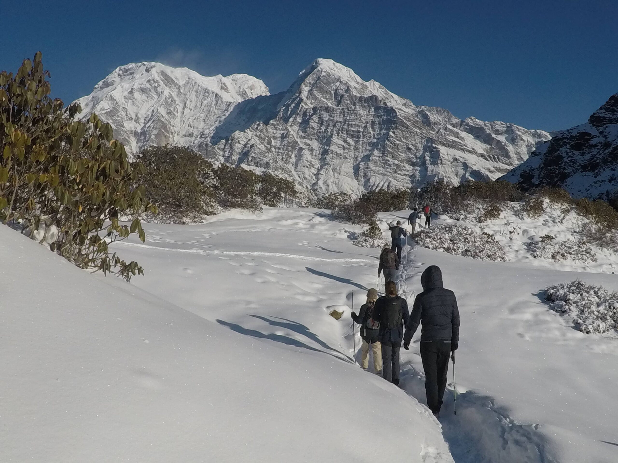
Early afternoon I reach Nar Gaon. I stroll around the village, thinking about the next days. Tomorrow I want to set off early to cross the Kang La Pass (5322m). Then it begins to snow heavily.

Next morning the whole valley is covered with a thick layer of snow. All I can do today is stay here and wait. I go for a walk through the village, the warm sun melts the snow quickly. In the evening the weather finally improves. The sky clears, revealing Pisang Peak and Kanguru, illuminated red by the setting sun.

Kang La (5322m)

My alarm goes off at 3, at 3:30 I start from the lodge. The stars in the sky and my headlamp are guiding my way through the night. I move up the valley quickly, trying to reach the pass as early as possible before the clouds roll in. For some time I follow a little stream, the trail is faintly visible through the snow. I ascend the slope to my right, then I continue west. After a while the narrow valley opens up a bit. At the head of the valley I can now see the trail again, zigzagging up the slope towards the pass. After what feels like an eternity I reach the end of the valley and join the path again! Now the hard work begins, up the long, steep slope towards Kang La. The last few hundred meters are particularly strenuous, through knee-deep snow. I need to rest a lot, the view east is incredible. Manaslu, Ngadi Chuli, Himal Chuli can be seen in the far distance, Kanguru, Pisang Peak, Chombi and Gyaji Kang are shining bright in the early morning sun.

Finally I reach the pass (5322m), marked by a cairn with a sign and prayer flags. I’m glad I reached pass early enough, hardly any clouds in the sky. And what a view! The whole Annapurna range is unfolding before my eyes. Annapurna II (7937m) is simply breathtaking and dominates the view. Lamjung Himal and the Myabasa Danda ridge to the south-east, Annapurna III, Gangapurna, Roc Noir and Grande Barriere south-west. I can even see the very tops of Machhapuchhare and Annapurna I – a rare pleasure from the north.

I have a long break on the pass, and then I start the 1700m descent to Ngawal. The first few meters down are steep and treacherous, over loose, slippery slabs. Very slowly, step by step I make my way downwards.

After a while the slope eases. I take it easy for the rest of the descent; it’s a long but easy stroll down to Ngawal. At 11am I reach Ngawal. It is still early, I don’t feel too tired and so I continue to Manang. I’m now back on the popular Annapurna Circuit.


Great Ice Lake

From Manang I’m heading for Tilicho Lake (4920m). In Khangsar I stop for tea. From Khangsar I go on, after a while the infamous landslide area begins.

Quickly I continue on the narrow trail, past bizarre looking rock formations, the river deep below to my left. I stay the night at the Tilicho Base Camp Lodge. Next morning I have an early start, it snowed at night and the landscape looks winterly. Grande Barriere and Roc Noir get closer with each step, the view back on Gangapurna, Chulus and the Marsyangdi Valley is awesome.

 Soon the path eases; some more walking on flat ground, then the lake comes in sight!

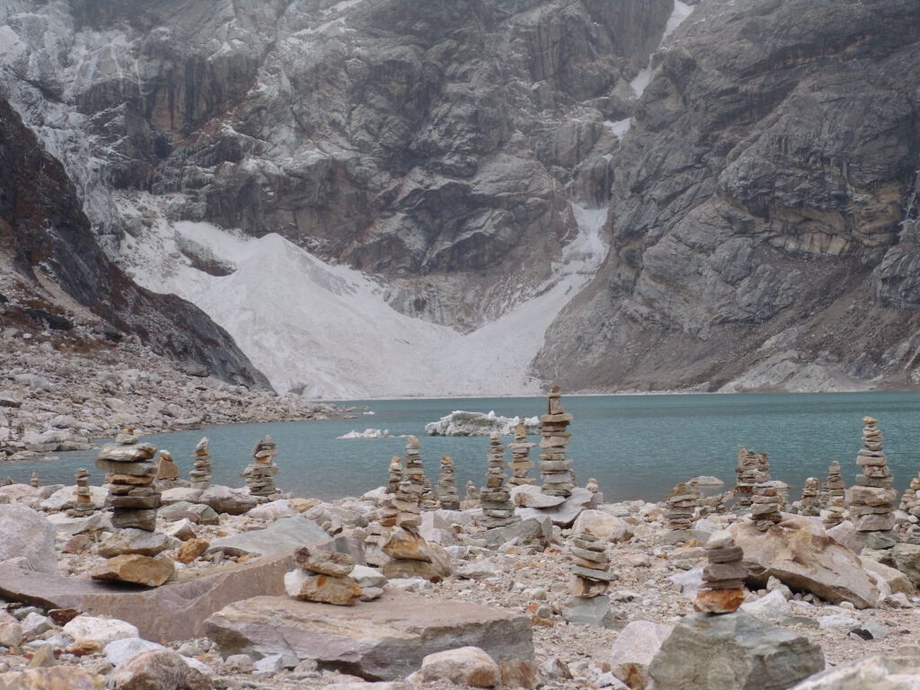
Roc Noir and Tilicho Peak are hidden by clouds, small avalanches roar down the slopes of the Great Barrier. Glaciers reaching right into the lake are cracking loud. I walk around the viewpoint at the south-eastern shore, it is cold and windy and after a couple of hours I go back.

Thorong La (5416m)

Next morning I walk in bad weather from Shree Kharka to Thorong Phedi. I pass Gunsang, Yak Kharka, Ledar, and cross the suspension bridge between Ledar and Thorong Phedi. In the afternoon the weather improves, I walk through another landslide area but the path is well trodden and easy to negotiate. On the slopes above I can see plenty of blue sheep.

This is snow leopard territory and I constantly keep an eye out for the big cat – in vain. Eventually I reach the lodges of Thorong Phedi (4530m), the sky clears for sunset revealing great views back on Gangapurna.

Next day I start at 5 towards the Thorong La Pass. Day is already dawning, making my headlamp needless. It is a bitterly cold, clear morning. I follow the line of trekkers trudging up the hill. Then the sun finally rises over the mountains, warming me up instantly.

At 8 I reach the Thorong La (5416m), notched in between the sixthousanders Khatung Khang and Yakawa Kang. The view from the pass exceeds my expectations. The Chulu Peaks, Putrun Himal and the ever present Annapurna II are towering skyhigh in the east; the Kali Gandaki Valley lies deep below in the west.

It is extremely windy and I start the long descent to Muktinath very soon. I more or less run down, losing altitude quickly. Before noon I arrive in Muktinath (3760m), a sacred place for both Hindus and Buddhists. I spend some time resting and watching the many Indian and Nepalese pilgrims at the main temple, and then I go to the neighbouring town of Ranipauwa for lunch.

Kali Gandaki Valley

In the afternoon I continue to the medieval town of Jhong. From the slopes north of Jhong I get fantastic views on the Nilgiris, Tilicho Peak and Dhaulagiri I, even the top of elusive Annapurna I comes into sight.

Walking through Jhong I’m looking for a place to stay the night but all the lodges seem to be closed. I have no choice but to go on with heavy legs. Dead tired and just before sunset I arrive at Kagbeni.

Next day I spend the morning exploring town and its surrounding area. With its ancient houses and beautiful location at the Kali Gandaki River, this place blows me away.

For a short distance I walk north along the Kali Gandaki River to the tiny settlement of Tiri. Like yesterday the weather is just perfect. In Tiri I hike up to the small monastery for more beautiful views. From this vantage point I can peek into Mustang, the former Tibetan kingdom in the north.

Two days later, I’m heading south along the Kali Gandaki to Kalopani. I take it easy and do plenty of side trips off the main trail. In the beautiful village of Naurikot I stop for breakfast and enjoy the awesome views, especially on Dhaulagiri I, the seventh highest mountain in the world.

Dhaulagiri I (8167m)

I continue west from Naurikot and ascend the lower slopes of Dhaulagiri to a small cave and waterfall. From here views are even better. At this point the Kali Gandaki Valley is one of the deepest valleys in the world, with an altitude as low as 2550m in between the eight-thousanders Annapurna and Dhaulagiri.

Khayar Lake (4600m)

From the lodge at Kopra Dhanda I start at 5 towards Khayar Lake, a sacred lake for Hindus at the foot of Annapurna South. It’s a hazy morning, I’m praying for good weather today. The trail to the lake is okay to find, frequently walked by pilgrims. After a couple of hours I cross the snow line, at around 9 I reach the lake at ~4600m. The shore is lined with tridents and bells, symbols of the Hindu god Shiva. I circumambulate the lake, scramble on the slopes around and take in the wonderful scenery. Clouds come and go, allowing close-up views on Fang and Annapurna South occasionally.

Through thick fog I walk back, retracing my own footsteps in the snow. The atmosphere is eerie, the view very limited. Luckily it doesn’t rain.

Next day I descend in the rain from Kopra Dhanda to Tadapani through a dense forest. I pass Bayeuli and Dobato, in the afternoon I reach the lodges of Tadapani, beautifully located at a scenic clearing.

The trek comes to an end with a spectacular sunrise next morning, the Annapurnas rising majestically one last time.

Tadapani sunrise: Annapurna South, Hiunchuli, Annapurna III, Machhapuchare, Annapurna II

—–Tobias Pantel —–

Why You Should Visit Nepal!

Nepal is one of the best tourist destinations in Southeast Asia. The country, located between two giants, India and China, is filled with varieties of beautiful natural features as well as diverse cultures. Here are some reasons to visit the beautiful country, Nepal.

The highest mountain in the world

Nepal is known as the home of the tallest peak of the world, Mt. Everest. It is located on the northeast side of Nepal and borders with India in the east and Tibet in the north. The majestic mountain lies in the Khumbu region, which is mostly inhabited by the Sherpa community. Due to this reason, Sherpa people have now become synonymous with mountains and mountaineering.

Various trekking routes in the Khumbu region celebrates the beauty of Everest through multiple angles. The majority of the tourists come here to trek till Everest Base Camp, but the daring ones aim for the summit. Every year, thousands of tourists flock to the Khumbu region to bask in the scenic views of Everest and its neighboring mountains like Ama Dablam, Nuptse, and Lhotse.

Besides the Base camp trek, there are other alternatives in the Khumbu region like Island Peak trek and Gokyo Lakes, where tourists can enjoy the serene beauty of the region. To travel and trek in the Kumbu region, tourists need to prepare necessary permits before heading out.

Different culture

Nepal is one of the culturally diverse countries in the world. Due to this reason, Nepal stands out from rest in terms of culture. The country houses 126 ethnic groups, and the government has recognized 59 indigenous nationalities. All these ethnic and indigenous communities have their own set of cultures and traditions, thus making each of them unique and charming. The mutual harmony that coexists between all these different cultures also highlights the charms of Nepal. 

Delicious variety of cuisines and friendly people

The diverse culture gives birth to a wide range of cuisines across the country. From east to west, various foods are unique to that particular region only. Dal Bhat (rice and lentil soup) is the staple food of the country, and besides that, there is a wide range of food that suits the palate of each tourist who visits Nepal.

Momo, Newari Khaja set, and Thakali khana set are some of the most popular dishes one should not miss out when in Nepal.

According to geography, climate, and crop availability, different communities have their unique cuisine. For example, the Newari population is mostly inhabited in the hilly region like Kathmandu valley, so they have a variety of meat and vegetable dishes. For the Sherpa people, potato, barley, and maize are the staple crops, so their dishes also revolve around these crops.

Similarly, the Gurungs who mostly inhabit the western hills primarily include buckwheat and millet in their cuisines. Enjoy delicious food served by lovely and welcoming people. The warm hospitality of the Sherpas in the Khumbu region, as well as Gurungs and Thakalis in the Annapurna region, adds inviting and pleasing charm. You would want to revisit Nepal once you have tasted their local cuisines and warm hospitality.

Land of Tigers and Rhinos [Abundance of wildlife and bird watching destination]

The dense forests of Nepal are home to a variety of flora and fauna. In the south, rare and endangered animals like tigers and rhinos are found. Especially in the southwestern side of the country, there is an abundance of tigers and rhinos. These animals are found within protected areas like Chitwan National Park and Bardia National Park.

Along with tiger and rhino, elephant, water buffalo (Arna), Blackbuck deer, and many other species of animals reside in the dense jungles of these protected areas. These national parks are also the perfect place for bird watching activities. During wintertime, a wide range of migratory birds like a mallard, common teal, and grey-headed lapwings come from the north to these forested regions and spend their winter here. Thus, winter is the perfect time for bird enthusiasts to go and do bird watching.   

Religious diversity

Even though the majority of the population is Hindus, Nepal is a secular country where people respect each other’s festivals and celebrations. More than 80% of the population follows Hinduism, so the majority of people celebrate festivals like Dashain and Tihar heartily.

Similarly, 8% of the people follow Buddhism, and their main festival is Buddha Jayanti, where they celebrate the birth of Gautam Buddha. 4% of the Islamic population celebrate various festivals annually, like Ramadan. The ethnic and indigenous communities of Nepal follow Hinduism, Buddhism, or a mix of both.

Peace, Serenity and Stunning views

The tranquility of the serene and stunning views is another unique quality of Nepal. In the mountainous region, the beautiful villages are surrounded by scenic views of mountain ranges, thus making it the perfect place to relax and enjoy the beauty of nature. There are also cities and towns in the hills, where tourists can enjoy some quiet time. The best example is Bandipur, a small village in Tanahu, where the peaceful environment is accompanied by picturesque views of Annapurna and Dhaulagiri ranges.

Around Kathmandu Valley as well, there are various viewpoints where the splendid mountain vistas are visible. Nagarkot and Dhulikhel are two famous places where tourists can get such views and enjoy the tranquility near the bustling capital.  

Beautiful Lakes

Most of the lakes of Nepal are freshwater and are formed by the melting of glaciers. Pokhara, the second biggest city in the country, is also known as the city of lakes. Along with the famous Phewa, there are other lakes like Begnas, Rupa, and Khaste lakes, which are all equally beautiful and breathtaking.

Besides these, there are several other scattered throughout the country. Rara Lake, the deepest and biggest freshwater lake of Nepal, lies in the far-western region of Nepal, is another famous scenic lake of the nation. It is said that the lake changes its color into different shades of blue every season.

Due to the ecological value of this lake, Rara National Park was established in 1976. Gosainkunda and Tilicho lakes are some of the holy lakes of Nepal that are visited by thousands of pilgrims every year.   

Rich in art and architecture

Nepal has diverse art and architecture, signifying the different cultures. Handicrafts are one of the most popular representations of the Nepalese art. Various communities and regions have their unique trademark in craftsmanship. For example, Palpa is renowned for handmade Dhaka prints, which are then made into different things like purses, shawls, and coats. Similar to these handicrafts, the architecture is also distinctive.

Generally, Nepalese architecture exhibit three styles that are Stupa, Pagoda, and Shikhara style. The architecture of houses in Chitwan and Solukhumbu is entirely different. The ones in the south are made to withstand heat and are made with bamboo, while in the north, stone tiles and houses are pretty common.

Trace the birthplace of Lord Buddha at Lumbini

Gautama Buddha, the founder of Buddhism, was born in Lumbini, Nepal. Thousands of tourists flock to this pilgrimage site every year to pay homage to the birthplace of Buddha. In the premises of Maya Devi temple, there are twenty-five monasteries built by various countries like Thailand, Cambodia, German, China, and many more. Tourists can learn more about Buddhism by visiting these monasteries. Tourists can pay respects to the holy birthplace and also explore the museum as well as yoga and meditation centers.

Experience adventurous activities

The best adventurous activity to do in Nepal is trekking. The country is blessed with many great and majestic mountain ranges and rugged trekking routes, making it the best place for backpack traveling and trekking. Various trekking routes are graded from easy to strenuous, thus fitting the taste and level for every tourist.

Easy treks can mostly be done within a week, and the best example for it is Poonhill-Ghorepani trek in the Annapurna region. For strenuous trekking options, Everest Base Camp trekking would be the best. There are other treks like Tamang Heritage Trek, where tourists get to learn about the Tamang culture and traditions.

Along with trekking, the country is famous for various adventurous activities like rafting, bungee jumping, and rock climbing.

Naturally gifted country

This small country, with the average north-south distance of 193 km comprises of flora and fauna ranging from tropical trees in the south to pine and fir trees grown in the alpine climate in the north.

The climatic variability and the rich biodiversity of Nepal is one of a kind. Nepal homes various rare and endangered animals like the snow leopard, birds like the spiny babbler, and plants like the Himalayan Yew (Yarsagumba). The country is also abundant with various kinds of freshwater resources ranging from ponds to rivers. Most of these water bodies originate from the melting snow of the Himalayas.

Pilgrimage and Pleasure

Alongside Lumbini, there are numerous temples and religious sites that are always crowded with pilgrims from around the world. The holy Hindu temple of Pashupatinath, dedicated to Lord Shiva, is located at the heart of Kathmandu.

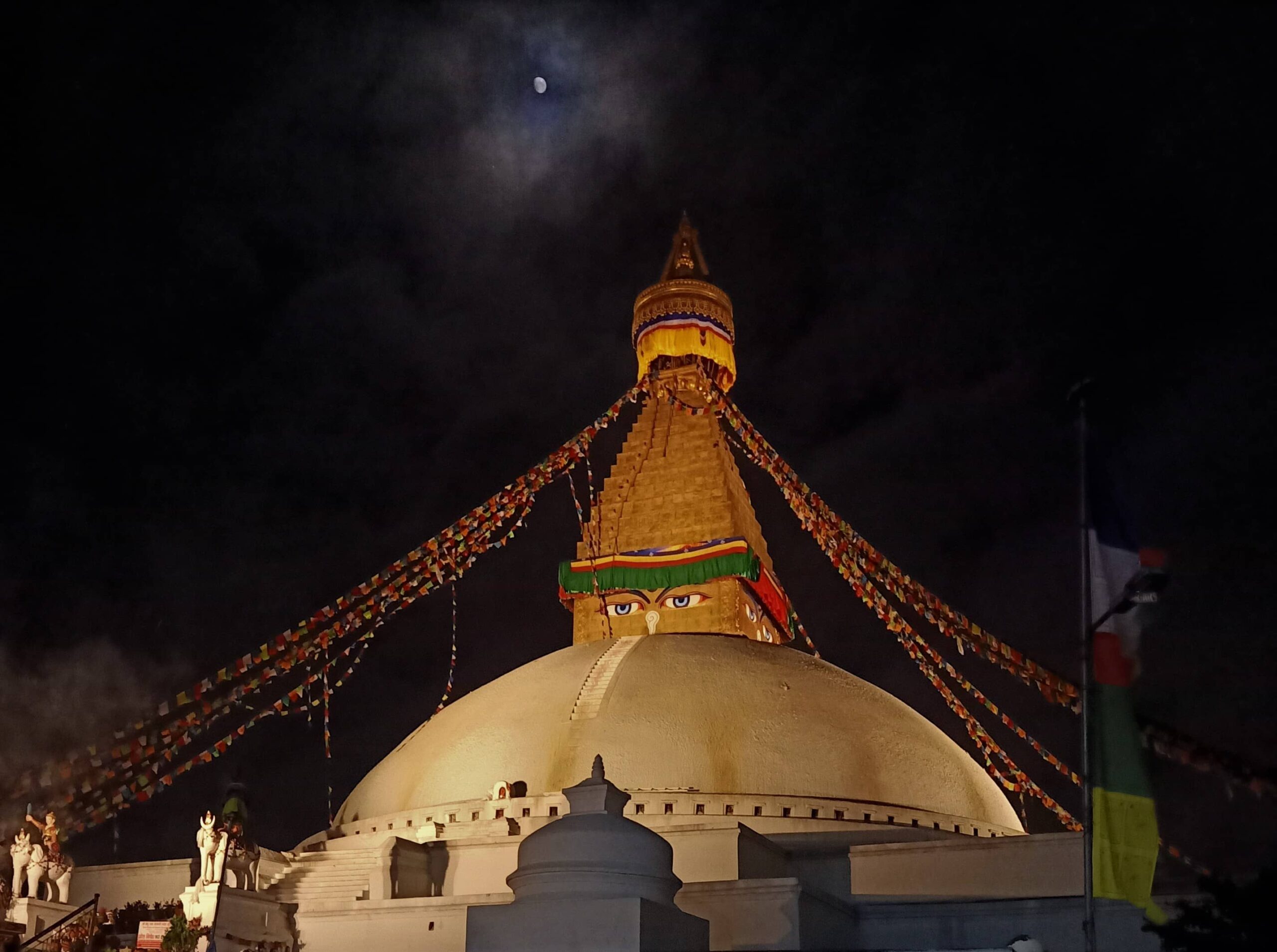
Similarly, Boudhanath Stupa, a revered site for Buddhist pilgrims, is also found in the capital city. Besides these religious landmarks, there are many other temples and stupas around the country that hold sacred values to the local people. Kalinchowk Bhagwati, Manakamana, and Muktinath are some of the temples that are frequented by pilgrims every year.    

Mardi Himal Trek: Short Adventure in Nepal

Introduction

Mardi Himal Trek takes trekkers through an isolated area of the Annapurna region to present an unadulterated and less-trodden path that meanders towards the base camp of the Mardi Peak. It is a journey that is an off-the-beaten-path adventure, perfectly suited for trekkers who are looking for destinations with fewer crowds. The Mardi Himal Trek is located just east of the famous Annapurna Base Camp Trek and presents trekkers with a less-frequented terrain flanked by the Machhapuchhre Peak.

The journey is also a great way to experience the authentic cultural diversity of eastern Annapurna. Villages of Gurung and Magar ancestry are scattered throughout the trekking trail, each with ethnic groups that speak their dialect and have their unique cultural traditions.

It is a common sight to come across herds of domesticated cattle heading off to pastures while trekking. Passing through the villages, trekkers can also see most local people involved in activities like pottery, producing and selling handicrafts and collecting medicinal plants.

In like manner, the cultural beauty of Mardi Himal Trek is equally rivaled by its unique and notable wildlife as well. The variation of forest cover persisting in accordance with altitude and topography provides a wide range of habitats to several animal species, especially for a wide variety of migratory spring and autumn birds.  

The Mardi Himal Trek Location

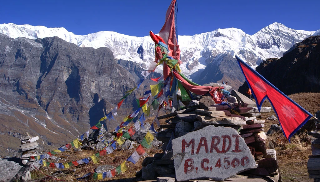
Mardi Himal Base Camp

The trekking journey to the base camp of Mardi Himal starts from Pokhara. The city of Pokhara is usually the starting point of many of the Annapurna region’s treks. Usually, trekkers can drive from Pokhara to Phedi and then start the trek from there, following the path that then leads to the village of Pothana. From there, the path then snakes through the alpine foothills of the river valley until eventually, it rises in elevation and branches out above the tree-line at 3,300 meters.

Once the tree-line is crossed at a site called High Camp, the change in the terrain is quite noticeable. The emerald woodlands of the lower foothills now resemble rugged high mountain landscape with the skyline decorated with amazing panoramic views of the Annapurna peaks. The Mardi Himal Trek also presents a wide range of topographical features of the eastern Annapurna region. The path initially starts through sub-tropical lowlands where lush rhododendron woods cover the landscape in bright canopies. The woods also harbor many species of orchids.

Likewise, throughout the journey, trekkers are in constant company with views of the Himalayas like the Annapurna massif, Mount Machhapuchhre, Gangapurna Himal, Lamjung Peak, Tukuche Peak, as well as the Mardi Himal among many others. From the lowland woods, the Mardi Himal Trek has pathways that then branch up the elevation towards pine-clad hills and juniper hamlets until the tree-line is crossed and the terrain then becomes a mosaic of alpine shrub-land and vast meadows.   

Mardi Himal Trekking Route

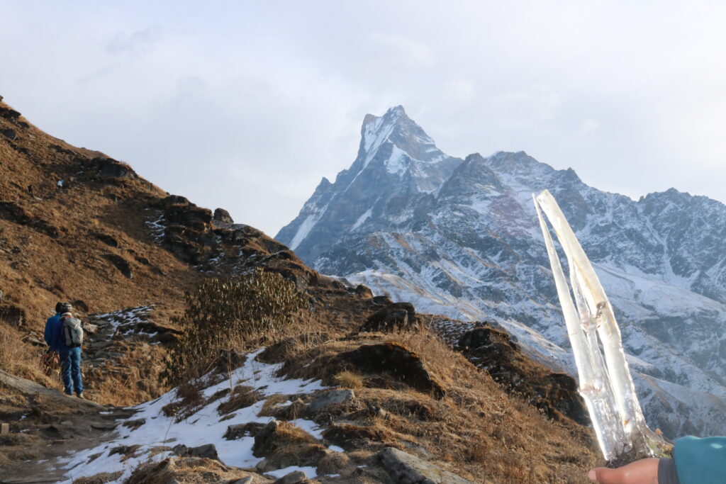
Machepuchra Himal on the way to Mardi Himal Trek

Kathmandu – Pokhara – Pothana (1,925 meters/4 Hours Trekking)  

The Mardi Himal Trekking journey begins from Pokhara. Trekkers can opt to take a short flight from Kathmandu to Pokhara, or they can drive to the lake-side city. As stated, from Pokhara, the next destination of the trek is a site called Phedi. From there, it is a steady trek through the woods towards Dhampus, and then to Pothana.

Pothana – Forest Camp (2,600 meters/4 Hours Trekking)

The next overnight destination along the Mardi Himal Trek is a site called Forest Camp. The pathway from Pothana leads to a place called Pitam Deurali. This is where the trail diverts away from the main Annapurna Sanctuary Trek and instead runs through the dense oak woods towards Forest Camp. The forests along the journey are dense and brimming with avifaunal life. The Forest Camp, also known as “Kokar” offers quite basic lodges for accommodation and rather imitates a homestay experience.

Forest Camp – Low Camp (3,150 meters/5 Hours Trekking)

The Mardi Himal Trekking trail continues from Forest Camp to Low Camp, darting through some of the last low-lying woodlands. As the trail picks up elevation, the vegetation along the terrain changes as well, from mighty woods to alpine shrubs. Rhododendron trees tend to be covered with moss and lichen, and eventually- the landscape becomes embedded with ferns. Low Camp presents mesmerizing views of Mount Machhapuchhre rising above the valley.

Low Camp – High Camp (3,700 meters/4 Hours Trekking)  

Mardi Himal Low Camp

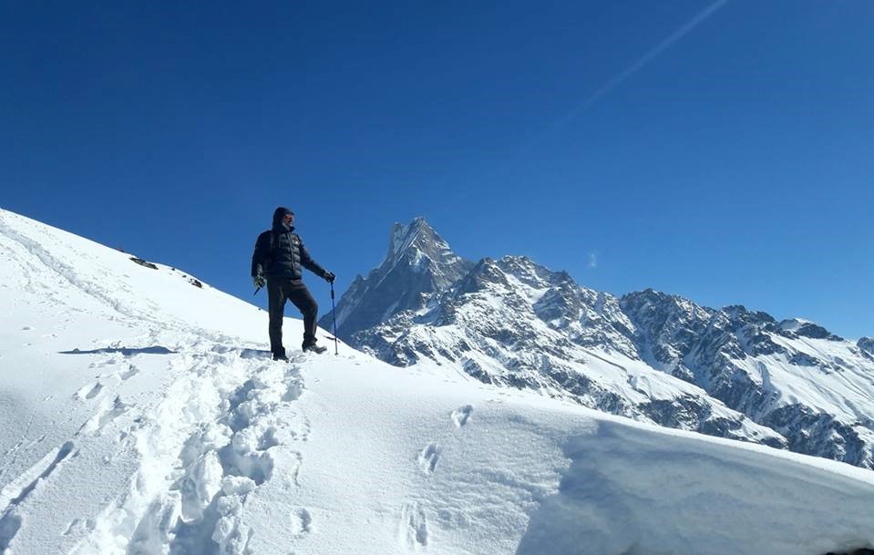
Trekking an hour or so from Low Camp, the trail finally breaks out above tree line and opens towards vast meadows and pastures that are more rugged. The western skyline is decorated with the view of the Annapurna South and the Hiunchuli Peak. The trail continues along the Mardi Himal ridge, mainly snaking through grass pastures where isolated rhododendron bushes ornament the otherwise even land. Colorful Danphe pheasants are often spotted on this section of the trail.

High Camp – Mardi Himal Base Camp (4,500 meters/4 Hours Trekking)

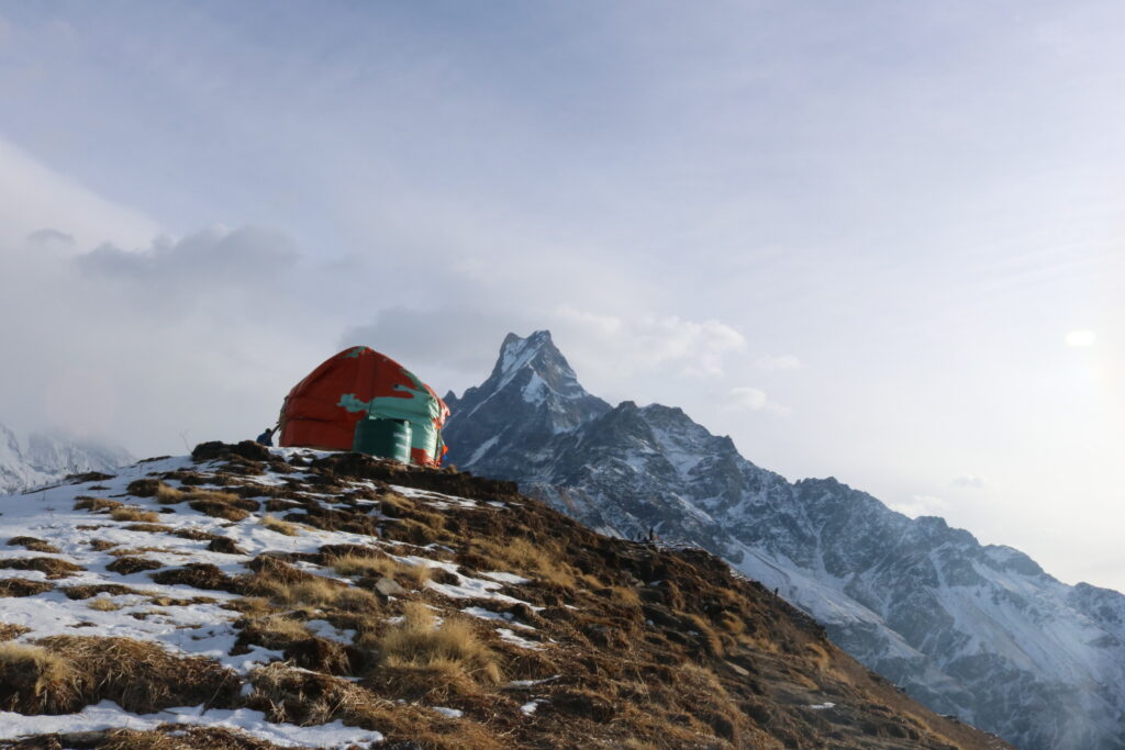
Mardi Himal High Camp

High Camp presents breath-taking views of the sunrise amidst the Annapurna Peaks. From High Camp, the path then twines up the ridge towards Mardi Himal Base Camp. The path to base camp is a well-established trail that traverses through the grasslands and includes a couple of steeper sections. The pastures here are often laden with grazing Dzos (yak/ cow crossbreds), as well as fluttering Danphe pheasants. In the summer, herds of sheep and goats from lower villages are brought up to graze in the area. As such, several herder’s huts are scattered along the trail. The path finally reaches the base camp of Mardi Himal from where one can look down into the Annapurna Sanctuary in the valley below, as well as panorama views of the spectacular south face of Annapurna and all of the peaks that surround the Sanctuary, including Hiunchuli and Machhapuchhre.

Best Time for Mardi Himal Trek

The best time for Mardi Himal Trek is during the spring and autumn months. Spring occurs from March to May, and autumn lasts from September to mid-December. Although Mardi Himal Trek can be done all year round, the spring and autumn months provide the best visibility and clarity of the peaks.  The weather conditions during these peak-trekking seasons remain suitable for trekking with very little chance of precipitation or other bad weather conditions. As such, they also present fewer chances of Kathmandu-Pokhara flight cancelations.   

Mardi Himal Trek Cost: Food and Accommodation

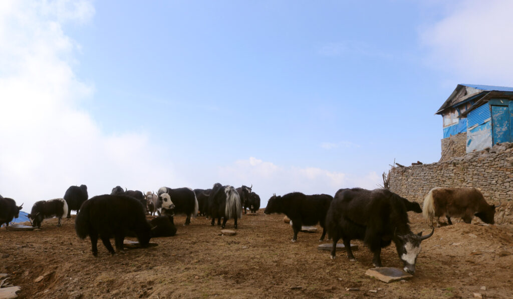
Yaks near Mardi Himal

As the Mardi Himal Trek is an off-the-beaten-paths journey, the accommodations along the trip are quite basic. Lodges are available for accommodation, and generally- they come in the form of small wooden wood-lodges with one dining area and small rooms with a sleeping bed.

However, in most lodges along the trek, there are no dining areas and meals are instead had in the kitchen itself, often with the family of the lodge-owner, evoking a home-stay experience. Usually, it costs about US$ 3 to US$ 10 per night. But the cost, of course, depends upon the quality and standard of lodges.

Likewise, both vegetarian and non-vegetarian meals are available during the trip. Although the food variety might not be grand, almost all lodges serve the staple food of Nepal- Dal Bhat (Rice and Lentils). It is important to carry food-allergy medications.     

Travel Tips for Mardi Himal Trek

On the way to Mardi Himal

It is advised to exchange foreign currency into local Nepali Rupees before the trekking journey. Mardi Himal Trek offers an isolated trekking experience and there are no ATMs or banks along the route. Thus, carrying local currency can help reduce the hassle. It makes it easier to buy and pay for things in the mountains.

Similarly, during peak trekking seasons, flights to Pokhara can be over-booked. The same goes for hotels in Pokhara as well. Thus, booking the trip early can help in reducing the chance of being caught up in the hassle of over-booked flights or delays.

Also, it is advised to carry one’s water purifying tablet or other forms of a water-purification method, like epi-pens. More often than not, lodges do not provide free drinking water. Thus, carrying your water-purification tablets will make the trip a lot easier and cheaper. It is certainly better than constant buying bottled drinking water in the mountain. Water purification tablets are also environment-friendly.

The Mardi Himal Trek is a moderate trekking trip and does not require one to have prior trekking experience to undergo. However, it is best to prepare oneself physically before the beginning of the trip. Doing regular cardio exercises like running and swimming can boost the body’s stamina and help during the trek.       

Conclusion

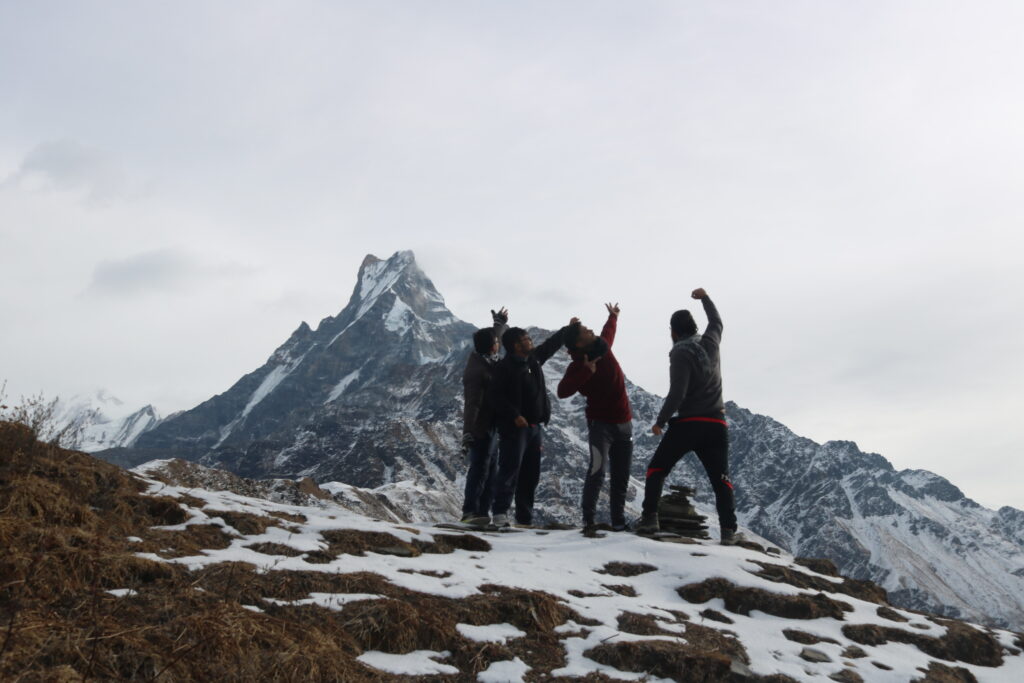
Macchepuchare View from Mardi Himal

Mardi Himal Trek is a beautiful hidden gem of the Annapurna region. It presents unexplored trails and new destinations to visit besides the popular routes of the region. The cultural setting along the journey also has a more authentic feel to it. It is a gorgeous journey through untarnished woodlands and far-off villages of the Annapurna where stunning sights of the Annapurna peaks are presented magnificently for trekkers to enjoy. There is no age limit to doing the trek, and the chance of Acute Mountain Sickness (AMS) occurring is also quite less. It is an awe-inspiring trip that encapsulates the best obscure features of the famous Annapurna region of Nepal.